Why Some Clouds Mean Rain and Others Don’t
Discover why certain clouds bring rain while others don't, exploring cloud types, formation, and weather patterns.
Clouds are one of nature’s most visible indicators of the weather, but not all clouds mean rain is on the way. While some clouds signal impending showers, others float across the sky harmlessly, bringing no precipitation. Understanding why some clouds produce rain and others don’t involves delving into how clouds form, the types of clouds, and the atmospheric conditions that lead to rainfall.
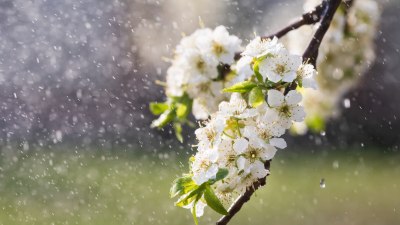
At its simplest, a cloud is made up of tiny water droplets or ice crystals suspended in the air. When enough moisture gathers, and the conditions are right, these droplets combine to form raindrops that become heavy enough to fall to the ground as precipitation. However, not all clouds contain sufficient moisture or conditions to generate rain, which is why some merely drift by without a drop falling to the earth.
The Basics of Cloud Formation
Clouds form when moist air rises, cools, and condenses into tiny droplets or ice crystals. This process typically begins when warm air containing water vapor is lifted over cooler areas, mountain ranges, or fronts where two air masses meet. As the air ascends, the temperature drops. When it reaches the dew point, the air becomes saturated, and water vapor condenses around small particles such as dust or salt, creating visible clouds.
The temperature in the atmosphere and the availability of moisture play critical roles in cloud formation. Without enough moisture or cooling, clouds may never fully develop. Additionally, the shape and size of clouds depend on air currents and atmospheric stability.
Classification of Clouds
Meteorologists classify clouds based on their appearance and altitude, which also helps predict whether precipitation will occur. Clouds are broadly grouped into high, middle, and low altitude clouds along with clouds that have vertical development.
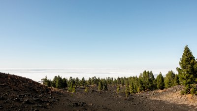
High clouds, such as cirrus, cirrostratus, and cirrocumulus, form above 20,000 feet. They typically consist of ice crystals due to the cold temperatures and are thin and wispy. High clouds rarely produce rain that reaches the surface because the moisture often evaporates before falling.
Mid-level clouds, including altostratus and altocumulus, form between 6,500 and 20,000 feet and are composed of water droplets or ice crystals depending on temperature. These can signal changes in weather patterns, and altostratus clouds may thicken to produce light rain or drizzle.
Low clouds such as stratus, stratocumulus, and nimbostratus form below 6,500 feet and are primarily made up of water droplets. These clouds are more likely to produce rain, especially nimbostratus, which often brings steady precipitation over extended periods.
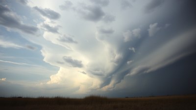
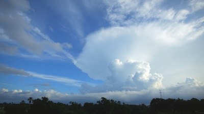
Clouds with vertical development, like cumulus and cumulonimbus, can extend through multiple altitude layers, sometimes up to 60,000 feet or more. These are the clouds most associated with heavy rain, thunderstorms, and severe weather because the strong upward currents allow droplets to grow large enough to fall as rain or hail.
Why Some Clouds Don’t Bring Rain
Not all clouds bring rain for several reasons. A key factor is cloud thickness and moisture content. Thin clouds, such as cirrus, have limited moisture and particles, so the water droplets or ice crystals are sparse and light. These clouds can indicate moisture at high altitudes but lack the density to produce precipitation that reaches the ground.
Clouds also require sufficient vertical development to generate rain. When the upward movement of air is weak, droplets remain small and can evaporate before falling. This evaporation, known as virga, is often seen under clouds when precipitation falls but disappears mid-air due to dry air beneath.
Atmospheric stability affects clouds' ability to produce rain. In a stable atmosphere, vertical air movement is suppressed, leading to flat, layered clouds with limited precipitation potential. Unstable conditions promote stronger updrafts causing cloud droplets to combine, grow, and eventually fall as rain.
What Conditions Lead to Rainy Clouds?
Rain forms when cloud droplets collide and merge into larger drops. This starts with clouds containing abundant moisture and strong upward movement of air to keep droplets suspended long enough to grow. As droplets become heavy, gravity pulls them down as rain.
Cumulonimbus clouds are prime producers of rain and thunderstorms. They form in unstable atmospheres where warm moist air rapidly rises. The vertical growth in these clouds creates towering structures, with upper parts freezing into ice crystals that fall and melt to form raindrops.
Nimbostratus clouds are another major rain bringer, producing steady, prolonged rainfall rather than intense storms. They generally occur with warm or occluded fronts as a large air mass slowly rises, cooling moisture steadily and saturating thick cloud layers.
Clouds formed along weather fronts often lead to rain because the meeting of different air masses results in air being forced upward, cooling, and condensing moisture efficiently. The type of front and temperature differences determine if the precipitation is light, steady, or heavy.
Role of Temperature and Humidity
Temperature gradients in the atmosphere affect cloud precipitation. Warmer temperatures allow clouds to hold more moisture, but if the air is too warm or dry below the cloud base, raindrops might evaporate before reaching the ground.
High humidity near the surface favors rain reaching the ground. When humidity is low, precipitation can evaporate in the dry air, creating virga. Therefore, even though a cloud may produce rain, the surrounding atmosphere determines whether it reaches us.
Cloud Development and Lifecycle
Clouds go through formation, growth, maturity, and dissipation phases. During growth, hydrometeors (water or ice particles) grow in size until they precipitate. Mature clouds with strong updrafts and ample moisture tend to drop rain efficiently.
As clouds dissipate, evaporation dominates and rain stops. This cycle explains why some rain showers are brief and localized, while others last longer and cover wide areas.
Clouds That Commonly Don’t Bring Rain
Cirrus clouds are thin and wispy and indicate moisture far above without rain. They often precede weather changes but don’t produce precipitation themselves.
Altocumulus clouds are patchy and scattered, generally not thick or moist enough to cause rain. However, their presence may hint at atmospheric instability.
Stratocumulus clouds close to the earth’s surface may produce drizzle but usually no significant rain, mostly because of limited moisture and weak vertical motion.
Indicators That Clouds May Bring Rain
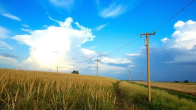
Growing cumulus clouds, especially those developing vertical towers, are clear signs rain could follow. Their towering nature shows strong convection and moisture, precursors to thunderstorms or showers.
Darkening cloud bases and thickening clouds often mean increasing moisture loads, making rain more likely.
Nimbostratus clouds, which are dense and cover wide sky areas as gray sheets, often arrive with consistent rains or snow.
How Geography Influences Cloud and Rain Formation
Geography such as mountains and bodies of water influences cloud formation dramatically. Mountains force air upwards, cooling it to form clouds that often produce rain on windward slopes. This orographic effect leads to wetter areas on one side and drier conditions, or rain shadows, on the other.
Lakes and oceans provide moisture that feeds clouds and precipitation nearby. Coastal areas often see more clouds and rain due to these moisture sources combined with land heating cycles.
Human Impact and Cloud Behavior
Urban areas can modify cloud formation patterns through heat islands and pollution. Particles from pollution provide nuclei that can increase cloud droplet formation but sometimes reduce rainfall by producing many tiny droplets that don't merge well into raindrops.
Climate change also influences clouds and rainfall patterns. Increasing global temperatures affect moisture distribution and atmospheric stability, which can alter how clouds develop and whether they produce rain.
Using Cloud Observations to Predict Rain
Weather forecasting relies heavily on cloud observations to anticipate precipitation. Recognizing the types of clouds and their behavior helps meteorologists predict whether rain will occur soon or if a dry spell persists.
Cloud radar, satellites, and ground observations combine to provide real-time data on cloud thickness, moisture content, and vertical development. These tools improve rain predictions and help warn about severe weather.
Summary of Key Factors
In essence, whether clouds produce rain depends on several interrelated factors: moisture availability, air temperature, atmospheric stability, vertical air currents, and environmental conditions like geography and humidity. Thick, moist clouds with strong upward motion generate raindrops that fall to the ground, while thin or stable clouds may carry moisture but fail to precipitate.
Understanding these factors helps explain why some clouds are just a lovely backdrop in the sky while others deliver the rain that shapes our weather patterns and ecosystems.