Why High Pressure Often Brings Clear Skies
Explore why high pressure systems typically result in clear skies and pleasant weather conditions, explained with atmospheric science.

Image created with Flux Schnell
Understanding the weather patterns that lead to clear skies often begins with grasping the concept of atmospheric pressure. High pressure systems, or anticyclones, are key players in shaping the skies above us. These systems, characterized by higher atmospheric pressure relative to surrounding areas, commonly bring about clear, calm weather. But why does high pressure so frequently result in blue skies and sunshine rather than clouds and precipitation?
The atmosphere exerts pressure due to the weight of the air above a point on Earth's surface. This pressure varies in location and time due to temperature differences, moisture content, and Earth's rotation. When a region experiences high atmospheric pressure, the air there is denser and more compressed compared to adjacent lower pressure areas. This difference affects vertical air movement significantly, influencing the formation or dissipation of clouds.
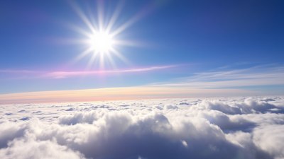
At the heart of clear weather under high pressure is the process of air sinking from upper levels of the atmosphere toward the surface. Known as subsidence, this downward movement causes air to warm as it approaches lower altitudes—a phenomenon based on the principles of adiabatic compression. As the air compresses, its temperature rises, increasing its capacity to hold water vapor.
Since warmer air can retain more moisture, the relative humidity of the sinking air decreases as it warms up, meaning the air becomes less saturated with water vapor. This drying effect discourages cloud formation because clouds develop when air reaches saturation and water vapor condenses into tiny droplets or ice particles. Therefore, the warming and drying influence of high pressure inhibits cloud development.
In addition to these thermodynamic effects, high pressure systems typically entail outward horizontal airflow from the center of high pressure, which further stabilizes the atmosphere. Air tends to diverge at the surface from the high pressure center, suppressing the upward movement of air parcels necessary for cloud formation and storms. This suppression encourages radiative cooling at night, leading to colder temperatures but clear skies.
Geographically, high pressure areas often form in regions where air descends due to large-scale circulation patterns. For example, subtropical highs such as the Azores High in the Atlantic or the Pacific High influence vast expanses of weather by generating stable, dry conditions that dominate much of the year in those regions.
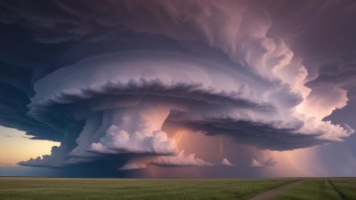
It's important to note that high pressure does not permanently guarantee perfect weather. During certain seasons or local conditions, clear skies under high pressure can coincide with temperature extremes, fog development near the surface, or other localized weather phenomena. However, the general pattern remains consistent: descending air under high pressure suppresses the formation of clouds and precipitation, making skies clearer than under low pressure systems, which promote rising air and stormier conditions.
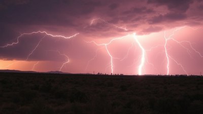
Low pressure, the counterpart to high pressure, involves rising air. As air ascends, it cools and the water vapor within condenses, leading to cloud formation and potential precipitation. This contrast in vertical air movement between high and low pressure is the fundamental reason behind their distinct weather characteristics.
Another aspect influencing the nature of high pressure systems is their strength and size. Stronger high pressure tends to produce more stable and uniform weather patterns, often bringing prolonged periods of sunshine and minimal wind. Conversely, weaker high pressure may allow for more variability, including the possibility of cloud development at the edges or from local convection.
High pressure also affects wind patterns due to atmospheric dynamics. Around a high pressure center in the Northern Hemisphere, winds rotate clockwise and outward, while in the Southern Hemisphere they rotate counterclockwise. This circulation pattern moves air away from the high and toward surrounding lower pressure areas, reinforcing the subsidence and the clear weather within the high.
On a microscopic level, the clarity of skies under high pressure can be linked to the absence of aerosols and particulate matter acting as condensation nuclei. Clouds need tiny particles in the air to begin the condensation process. Because high pressure systems often promote stable, dry air with less turbulence, the dispersion of these particles reduces and cloud droplets find less opportunity to form.
Moreover, the stability fostered by high pressure plays a role in radiation balance. During the day, sunlight can penetrate easily, heating the surface. At night, without clouds to trap outgoing infrared radiation, temperatures can fall significantly. This diurnal temperature variation is characteristic of high pressure conditions, especially in continental interiors far from oceans.
In human experience, high pressure days are usually pleasant for outdoor activities due to the low probability of rain and abundant sunshine. However, in winter, persistent high pressure can lead to temperature inversions where cold air is trapped near the surface, causing fog and poor air quality.
Weather forecasting relies heavily on identifying high pressure systems because they often indicate stable conditions for several days. Meteorologists use satellite imagery, barometric pressure readings, and atmospheric data to pinpoint these systems, anticipating the typical weather outcomes they bring.
The relation between high pressure and clear skies also has implications for agriculture, renewable energy, and health. Clear skies boost photosynthesis in plants but may increase exposure to ultraviolet radiation. Solar energy production benefits from the consistent sunlight under high pressure, while respiratory conditions might worsen if air becomes stagnant and pollutants accumulate.
In summary, the prevailing reason high pressure frequently brings clear skies is the downward motion of air, warming and drying the atmosphere, and stabilizing weather patterns. This stabilization inhibits cloud and storm formation, creating the often sunny, calm conditions we associate with anticyclones.
To conclude this exploration, understanding the dynamics behind high pressure systems reveals the intricate balance of temperature, moisture, and air movement shaping our weather. Recognizing these patterns enhances our appreciation for the daily variations in sky conditions and aids in prediction and planning across many sectors.