Why Clear Skies Can Follow a Severe Storm
Explore the meteorological reasons behind clear skies appearing after severe storms, including atmospheric processes and weather patterns.
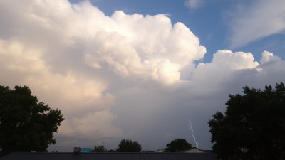
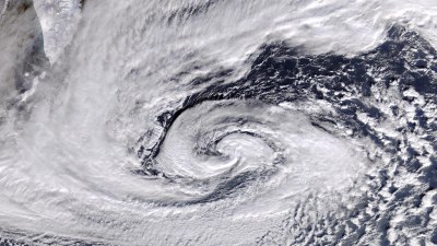
Image created with Flux Schnell
Severe storms often bring intense weather phenomena such as heavy rain, thunder, lightning, and strong winds. However, it is not unusual to witness clear skies and calm conditions shortly after these storms have passed. This shift from turbulent weather to tranquility intrigues many and is rooted in various atmospheric processes and weather dynamics. Understanding why clear skies can follow a severe storm requires examining the life cycle of storms, the behavior of air masses, and the interaction between different atmospheric layers.
Storms typically form when moist, warm air rises and cools, condensing to form clouds and precipitation. This rising air creates an unstable atmosphere, which can develop into severe weather if conditions are right. As the storm progresses, it alters the local environment significantly, affecting temperature, humidity, and air pressure. The aftermath of such disturbances often sets the stage for clearer skies due to changes in these variables.
Storm Formation and Atmospheric Instability
Atmospheric instability is key to the formation of severe storms. When warm, moist air at the surface encounters cooler air aloft, it becomes buoyant and rises rapidly. This process is called convection. As the rising air cools, water vapor condenses into droplets, forming clouds and releasing latent heat, which further fuels the upward motion. The intensity of this process determines whether a mild shower or a severe thunderstorm develops.
In many cases, storm cells organize within larger weather systems such as cold fronts, where a mass of colder air pushes beneath warmer air, forcing it upward. The advance of a cold front is often accompanied by a line of storms. Behind this front, conditions typically become more stable, explaining why clearer weather often follows storms produced along cold fronts.
Role of Cold Fronts and Air Masses
The passage of a cold front is a fundamental factor that can lead to clear skies after a storm. Cold fronts represent the leading edge of a cooler, denser air mass moving into an area occupied by warmer, moister air. As the front advances, it lifts the warm air abruptly, sparking the formation of clouds and storms. Severe weather commonly occurs along or just ahead of the front due to this forced ascent.
Once the cold front moves through, the air behind it is usually cooler and drier. The influx of this stable air mass suppresses further convection, reducing cloud formation and precipitation. This stabilizing effect consolidates the clearing conditions. In essence, the storm exhausts the unstable warm air, and the cold front replaces it with more stable air, which leads to clearer skies.
Post-Storm Atmospheric Dynamics
After a severe storm, several processes occur that contribute to clearer skies. One is the sinking motion of air behind the storm system. This sinking, or subsidence, compresses and warms the air, evaporating lingering clouds. Subsidence is a characteristic feature of high-pressure systems, which often build in after storms, reinforcing stable and clear conditions.
Additionally, the removal of moisture by precipitation during the storm reduces humidity, which limits the capacity for new cloud formation. The atmosphere becomes drier and less supportive of cloud development. These factors, coupled with the arrival of cooler air, create an environment favorable for clear, calm weather.
The Influence of High-Pressure Systems
High-pressure systems, also known as anticyclones, are commonly responsible for clear skies. When a storm dissipates, it is not rare for a high-pressure system to move into the region. High pressure suppresses vertical motion in the atmosphere, which prevents cloud formation. This effect is a direct consequence of descending air that warms and dries as it compresses.
High-pressure areas also tend to have light winds and minimal humidity, reinforcing clear and stable conditions. The correlation between the passage of a storm and the subsequent arrival of a high-pressure system explains why the weather can change so dramatically from violent to serene.
Radiational Cooling and Clear Night Skies After Storms
Clear skies following storms are often associated with rapid radiational cooling during nights. cloud cover normally traps outgoing infrared radiation, keeping nighttime temperatures higher. When clouds dissipate after a storm, the absence of this 'blanket' allows heat to escape more readily, resulting in cooler nights.
This cooling can stabilize the lower atmosphere by reducing convection and limiting cloud regeneration in the early morning hours. Hence, the cycle of clear skies perpetuates for some time, especially during calm, high-pressure conditions after the storm.
Role of Wind and Atmospheric Mixing
Storms often involve strong winds that mix the atmospheric layers, redistributing heat and moisture. Once the storm subsides, wind speeds typically diminish. Calm winds reduce the upward transport of warm, moist air that could reignite cloud formation, thereby allowing skies to clear overnight or within hours after the storm's passage.
This decrease in mechanical mixing helps establish a temperature inversion in some cases, where a layer of warmer air overlays cooler air near the surface, further suppressing vertical air movement and cloud development.
Variability Based on Storm Type and Geography
While clear skies commonly follow severe storms, the pattern can vary depending on the storm type and geographic region. Tropical storms, for example, may leave behind lingering moisture and cloud cover for extended periods due to their vast size and moisture transport. Similarly, mountainous terrain can influence how quickly clear skies return by affecting airflow and the drainage of cold air masses.
In contrast, mid-latitude thunderstorms often occur along well-defined fronts, leading to more rapid clearing as the high-pressure system settles in. Coastal areas may also experience slower clearing due to lingering marine moisture.
Unexpected Weather Phenomena Following Storms
Sometimes, the clearing phase after a storm may be punctuated by spectacular weather phenomena such as rainbows, virga (rain that evaporates before reaching the ground), or peculiar cloud formations. These occur because the storm's dynamics create optimal conditions for sunlight to interact with residual moisture.
The contrast between the clear skies and the remnants of storm activity can produce vivid and memorable sights, often signaling the transition from turbulent to calm weather.
Significance for Weather Forecasting and Public Awareness
Understanding why clear skies follow severe storms is not only interesting but also valuable for weather forecasting and public safety. Forecasting models incorporate knowledge of air mass changes, front passages, and pressure tendencies to predict post-storm weather conditions accurately.
Clear skies often provide relief after the stress of severe weather, but it's essential to remain cautious as some storms can be followed by rapid temperature drops or the development of phenomena like frost or fog, which may cause hazards.
Key Factors
In summary, the primary reasons why clear skies can follow a severe storm include the passage of a cold front bringing stable air, the formation of a high-pressure system with descending air, reduction in moisture and humidity, diminished convection due to cooling and calming winds, and the evaporation of clouds owing to subsidence.
These interconnected meteorological mechanisms create an environment where turbulence gives way to tranquility, highlighting the dynamic and ever-changing nature of Earth's atmosphere.
By examining these factors, one gains insight into the natural rhythms of weather systems and the transitions from chaos to calm that define severe storms and their aftermath.