Why Blizzards Can Happen With Clear Skies Nearby
Explore the fascinating reasons why blizzards can occur alongside clear skies just a short distance away, revealing nature's complex weather patterns.
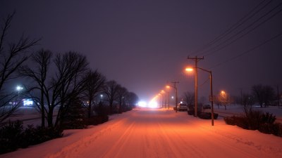
Blizzards are intense winter storms characterized by heavy snowfall, strong winds, and severely reduced visibility. They can pose significant hazards to transportation, infrastructure, and public safety. However, one puzzling phenomenon is that blizzards can sometimes occur even when clear skies are visible just a short distance away. This seemingly contradictory occurrence raises the question: why can blizzards happen with clear skies nearby? Understanding this requires an exploration of meteorological concepts, atmospheric dynamics, and the nature of winter storms.
To begin, a blizzard is defined by a combination of blowing snow and sustained winds exceeding 35 miles per hour (56 kilometers per hour), which leads to whiteout conditions with visibility dropping below a quarter-mile for at least three hours. Importantly, a blizzard doesn’t necessarily require heavy snowfall at all times; the blowing of existing loose snow by intense winds can sustain the blizzard conditions. This factor partly explains why blizzards can persist or occur despite localized differences in precipitation and sky conditions.
Weather systems typically responsible for blizzards are large-scale cyclonic storms that bring low-pressure systems combined with cold Arctic air masses. These storms produce snow through the uplift and cooling of moist air, resulting in snow flurries or heavy snowfall over broad regions. However, the geography and localized atmospheric dynamics often cause significant variability within the storm. While one area experiences heavy snow and strong winds, nearby regions may see clearer skies, calmer winds, or diminished precipitation due to factors like elevation, terrain, or the storm’s internal structure.
One key reason blizzards can happen alongside clear skies nearby is the presence of sharp gradients in temperature, humidity, and wind speed within the storm environment. These gradients arise because blizzards often occur along strong frontal boundaries—lines where cold, dry air masses meet warmer, moist air. Along these boundaries, weather conditions can change drastically over short distances. For example, on one side of a cold front, the air can be cold and dry with clear skies, while just behind it, a band of snow and strong winds may result in a full-fledged blizzard.
Furthermore, the phenomenon of blowing snow plays a significant role. Even after snowfall stops, strong winds can pick up loose snow from the ground—especially in open, flat areas or places with loose snowpack—and create blizzard conditions. This blowing snow reduces visibility and creates hazardous travel conditions, despite the absence of new precipitation. Meanwhile, an adjacent area sheltered by hills, buildings, or trees may experience relatively calm winds and clear skies, emphasizing the localized impact of wind-driven snow movement.
Topography and local terrain have a huge influence on blizzard formation and its spatial variability. Mountain ranges, valleys, and plateaus can channel or block winds, causing localized intensifications or weakenings of the storm’s effects. For instance, wind funneled through a narrow mountain pass can become much stronger than in an adjacent valley, lifting snow and producing blizzard conditions selectively. Similarly, snow deposition patterns vary, leaving some areas snow-covered and susceptible to blowing snow, while others remain comparatively bare and clear.
Atmospheric stability also influences how snow and wind interact. In unstable atmospheric conditions, vertical mixing allows stronger winds to reach the ground, which can stir up snow and sustain a blizzard even after snowfall wanes. On the other hand, stable layers can suppress downward motion of high winds, leading to calmer surface conditions nearby. This vertical variation can create patches of blizzard conditions interspersed with clear skies over surprisingly short distances.
The speed and movement path of the storm further contribute to the spatial variability of blizzards. Rapidly moving storms might dump heavy snow in a concentrated area while leaving adjacent locations in clear or only lightly snowing conditions. The wind field associated with the storm’s cyclonic circulation can also cause snow to be blown far downwind, creating blizzard conditions in areas that received little original snowfall, while near the storm center, the weather might temporarily clear.
Technological advancements in weather radar and satellite imaging have helped meteorologists observe these intricate patterns in blizzard events. Radar can detect snow intensity and its horizontal distribution, revealing bands or cells of heavy snowfall surrounded by lighter precipitation or clear areas. Satellite images help track cloud cover and temperature variations, illustrating how a storm system’s structure creates contrasting conditions side by side. These observations confirm that what appears as a uniform blizzard from a distance is often a patchwork of differing meteorological phenomena across relatively small scales.
Blizzards can also be influenced by specific weather phenomena that amplify or reduce snow and wind effects locally. For example, mesoscale banding, where narrow bands of intense snowfall develop within larger storm systems, can produce extreme localized snowfall rates and blizzard conditions. These bands can form due to feedback between uplift, cooling, and moisture availability, creating highly variable conditions within a single storm. Outside these bands, skies might remain clear or only slightly overcast, causing stark contrasts in weather conditions.
In addition, cold air damming can affect blizzard formation near mountainous regions. This occurs when cold dense air gets trapped against mountain slopes, altering wind patterns and temperature distributions. Such effects may enhance wind speeds or snow blowing in some areas, while blocking precipitation in others, contributing to the phenomenon of blizzards occurring adjacent to clear skies.
Human perception of weather can also shape the confusion over blizzards near clear skies. Because blizzards involve blowing snow, visibility can be drastically reduced even if new snowfall is absent. Traveling a few miles away may bring relief into clear skies, but this proximity can mislead observers about the scale of the storm. Weather warnings and advisories emphasize the importance of recognizing blowing snow and wind hazards, not just falling snow when preparing for blizzards.
The impact of blizzards with nearby clear skies is significant for emergency management and public safety. It challenges meteorologists to produce localized forecasts that capture these sharp contrasts, and it demands that drivers, travelers, and residents remain vigilant even when conditions appear calm nearby. Infrastructure resilience, including road clearing operations and communications, must account for the patchy nature of blizzard effects, ensuring quick response where visibility and wind hazards are most severe.
In summary, blizzards can happen with clear skies nearby due to the complex interplay of atmospheric dynamics, topographical influences, and wind-driven snow transport. Sharp gradients in air masses, localized wind accelerations, snow deposition patterns, and mesoscale storm features create environments where blizzard conditions exist in some places but not others, sometimes separated by just a few miles. Understanding these factors deepens our appreciation of winter weather complexity and highlights the challenges faced in forecasting and responding to severe storms.
Ongoing research continues to refine how meteorologists interpret and predict these phenomena. Advances in modeling, high-resolution weather data, and an improved grasp of snowpack behavior help provide clearer information about when and where blizzards will produce hazardous conditions amid seemingly tranquil surroundings. Recognizing the potential for blizzards with nearby clear skies ultimately can save lives and improve winter weather preparedness across afflicted regions.