What Happens in the Sky Before a Thunderstorm
Discover the fascinating atmospheric changes in the sky before a thunderstorm strikes, including cloud formation, lightning triggers, and wind shifts.
Thunderstorms are dramatic and powerful natural phenomena governed by complex atmospheric processes. Understanding what happens in the sky before a thunderstorm can reveal much about weather patterns and atmospheric science. This article delves into the various stages and conditions in the sky before a thunderstorm forms and strikes, from cloud development to electrical discharges and wind behavior.
The Role of Atmospheric Instability
Before a thunderstorm erupts, the atmosphere must reach a state of instability. This instability occurs when a parcel of warm, moist air near the ground becomes buoyant relative to the air above it. This warm air rises because it is less dense than the cooler air above it. The rising motion is a critical trigger for thunderstorm development, as it initiates cloud formation and vertical growth.
Atmospheric instability is typically associated with a temperature profile known as a lapse rate, where the temperature decreases rapidly with height. The steeper the temperature drop, the greater the potential for air parcels to keep rising. This condition is often measured by meteorologists using tools like weather balloons or by calculating indices such as the Convective Available Potential Energy (CAPE).
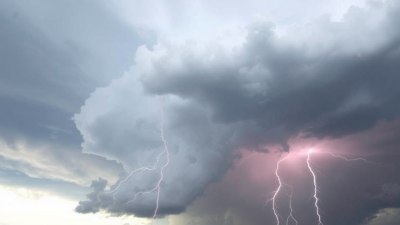
Cloud Formation: Cumuli to Cumulonimbus
The visual hallmark signaling an impending thunderstorm is the appearance and evolution of clouds. Initially, cumulus clouds start to appear in the sky. These are the fluffy, white clouds shaped somewhat like cotton balls. They result from warm, moist air ascending and cooling, causing water vapor to condense into tiny droplets.
As these cumulus clouds develop and the upward air motion strengthens, they can grow vertically into towering structures known as cumulonimbus clouds. This stage involves significant vertical development, often reaching altitudes of 10 to 20 kilometers (6 to 12 miles) in the troposphere. The towering cumulonimbus clouds are the primary thunderstorm-producing clouds.
Within these clouds, the atmosphere exhibits strong updrafts and downdrafts. The updrafts transport moisture and energy upward, while downdrafts bring precipitation and cooler air downward. The intense vertical movement within these clouds is often visible as an anvil-shaped top due to the spreading of the cloud at the tropopause – the boundary between the troposphere and the stratosphere.
Water Droplet Formation and Ice Processes
As the cloud extends higher, temperatures drop below freezing, causing the water droplets to freeze and form ice crystals, snowflakes, or hail. These ice processes inside the cloud play a significant part in generating the electrical charge differences needed for lightning.
The collisions between ice particles of different sizes lead to charge separation inside the cloud. Typically, smaller ice particles become positively charged while larger ones gather negative charges. This separation establishes the strong electrical potential difference between different regions of the cloud and between the cloud and the ground, setting the stage for lightning.
Changes in Sky Color and Visibility
In the hours or minutes leading up to a thunderstorm, the sky often takes on distinct visual cues. The lower sky near the horizon may appear darker or more ominous due to the dense moisture and developing storm clouds.
Sometimes the sky adopts a greenish or yellowish tint, which is associated with the storm's intensity and the presence of hail or large water droplets in the cloud bases. Meteorologists sometimes note that such coloration can be an indicator of severe storms approaching.
Visibility can rapidly diminish as rain shafts develop ahead of the storm, obscuring distant objects. Before the precipitation arrives, sudden gusts of wind may stir dust or move leaves, signaling changes in air movement.
Wind Patterns and Atmospheric Pressure Shifts
Wind behavior changes noticeably before a thunderstorm. Gust fronts, which are outflows of cooler air from downdrafts within the thunderstorm, often precede the main storm. These gust fronts can push the warm air upward, enhancing thunderstorm development further.
Additionally, a drop in barometric pressure signals the approach of the storm system. As the low-pressure region moves in, the surrounding air is drawn inward and uplifted, facilitating cloud growth and storm intensification.
Wind direction shifts can also be evidence of the approaching storm. Often, winds turn to blow from the southeast or southwest in many temperate regions before thunderstorms, bringing moist, unstable air from bodies of water or warmer land.
Humidity and Temperature Variations
Humidity levels typically rise preceding thunderstorm formation. The influx of moist air increases the relative humidity near the surface, saturating the lower atmosphere. This moist air is vital for cloud formation and precipitation processes.
Temperature can behave in complex ways. Sometimes a sudden cooling occurs if rain from nearby storms starts to fall in an area (virga), or if downdrafts bring cooler air downward. Otherwise, the ground and surface air may remain warm, fueling continuous upward movement of air.
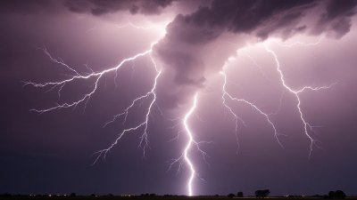
Electrical Activity and Early Lightning Signals
One of the most dramatic occurrences before a thunderstorm is the buildup of electrical energy within the clouds. While the main body of a storm sometimes produces immediate lightning, some lightning activity can be detected in early phases.
Scientists have observed weak electrical discharges and small-scale lightning flashes, sometimes called preliminary breakdown pulses, that precede major lightning strikes. These early electrical activities signal that the cloud’s charge separation is reaching a critical threshold.
The electrical field around the cloud intensifies as charge accumulates. This can sometimes be detected with sensitive instruments or occasionally perceived as static electricity effects on the ground or elevated objects.
The Role of Updrafts and Downdrafts
Strong vertical air currents define thunderstorm dynamics. Before the storm fully develops, powerful updrafts of warm, moist air sustain cloud growth and intensify turbulence. These updrafts create the towering appearance of cumulonimbus clouds and maintain the inflow of energy needed for the storm.
Once precipitation forms, downdrafts develop as rain-cooled air descends rapidly. These downdrafts can create gusty winds at the surface and promote formation of features such as gust fronts or microbursts—intense localized downdrafts.
Pre-Storm Phenomena: Haloes and Cloud Iridescence
Sometimes unique optical effects occur in the sky before a thunderstorm. Haloes around the sun or moon may appear due to ice crystals in the upper atmosphere, indicating moisture at higher levels. Similarly, cloud iridescence—irregular color patterns or rainbow-like displays—can occur when tiny water droplets or ice crystals diffract sunlight.
These phenomena, while not exclusive to thunderstorm development, often accompany the complex atmospheric conditions present before storms, hinting at the intricate weather patterns unfolding.
Detecting Thunderstorm Formation Through Radar and Satellites
Modern meteorology employs radar and satellite imagery to detect and analyze storm formation remotely. Before a thunderstorm reaches the surface, Doppler radar can identify clustering of precipitation echoes and vertical growth patterns characteristic of developing thunderstorms.
Satellites can monitor cloud top temperatures and structure changes, helping predict thunderstorm intensity and movement. These tools complement visual cues and in situ measurements, providing critical information for weather forecasting and safety warnings.
Bird and Animal Behavior Changes Before Storms
Though not part of the sky per se, animal behavior changes can sometimes provide indirect evidence of atmospheric changes before thunderstorms. Many birds reduce flight activity or seek shelter due to increasing wind turbulence, while insects may become less active. Such behavioral shifts stem from sensed changes in pressure, humidity, and wind patterns preceding storms.
The Impact of Local Geography on Pre-Storm Sky Conditions
Local geographical features can influence what happens in the sky before a thunderstorm. Mountains can force air to rise, enhancing cloud formation and storm initiation. Coastal areas often experience sea breezes that bring moist air inland, providing the fuel for thunderstorms.
Urban heat islands can also affect storm development by creating localized upward air currents due to surface heating. These complex interactions highlight how the sky's behavior before storms varies with location.
Summary of Key Indicators in the Sky Before a Thunderstorm
Key signs in the sky before a thunderstorm include the formation and vertical growth of cumulus clouds into cumulonimbus, changes in sky color such as darkening or greenish hues, shifts in wind direction and strength, a drop in barometric pressure, increasing humidity, and early lightning or electrical discharges within the clouds.
Understanding these indicators provides insight into atmospheric processes and helps anticipate storm development, improving preparedness and safety.
The next time you notice a swiftly growing towering cloud or experience a sudden gust with a drop in temperature, remember that these are the visible and tangible precursors of the immense power of a thunderstorm gathering strength in the sky.