What Makes a Nor’easter Different From Other Storms
Explore the unique characteristics of Nor’easters and how they differ from other types of storms affecting the northeastern US.
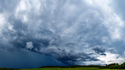
A Nor’easter is a type of storm that frequently impacts the northeastern United States, bringing heavy snow, rain, and strong winds. Understanding what distinguishes Nor’easters from other storms involves examining their formation, characteristics, and effects. These powerful winter storms get their name from the prevailing winds that blow from the northeast and are notable for the extensive damage and disruption they can cause.
Unlike typical storms, Nor’easters derive their energy from a combination of cold Arctic air and moist air over the Atlantic Ocean. This collision creates intense storm conditions that often result in blizzards, flooding, and coastal erosion. Their development is tied closely to the geography and atmospheric conditions specific to the eastern seaboard.
Formation and Development
Nor’easters commonly form along the East Coast in the late fall through early spring months when cold air masses from Canada meet warmer air over the Atlantic Ocean. This temperature contrast is a key factor in their development. The clash causes a low-pressure system to intensify and move northward along the coastline. As it moves, it draws moisture from the Atlantic, which fuels heavy precipitation.
There are two main types of Nor’easters based on their formation: coastal and inland. Coastal Nor’easters develop offshore, rapidly intensify, and often track close to the coast, delivering the most severe weather impacts including heavy snow and storm surge. Inland Nor’easters tend to be less intense, forming inland with less access to ocean moisture and thus usually producing more moderate weather.
Winds and Direction
One of the defining features of a Nor’easter is the strong, persistent winds that blow from the northeast direction. This wind pattern results from the low-pressure system’s counterclockwise rotation, typical in the Northern Hemisphere. The northeast winds contribute to significant coastal flooding and waves, affecting beaches, shorelines, and communities along the coast.
This contrasts with other storm systems like hurricanes, which have variable wind directions due to their cyclonic nature and generally blow from the south or southeast as they approach the US mainland. Thunderstorms and ordinary winter storms also lack the distinctive wind direction and scale seen in Nor’easters.
Precipitation Type and Intensity
Nor’easters are notorious for heavy snowfall, especially when cold air from inland meets wet air from the ocean. This snow can accumulate rapidly, sometimes exceeding several feet in certain areas. In comparison, other storms such as winter cyclones may produce snow but generally not in the quantities seen during intense Nor’easters.
In some cases, Nor’easters also bring mixed precipitation like sleet or freezing rain depending on the temperature layers in the atmosphere. Coastal regions may experience heavy rain instead of snow if temperatures are above freezing, causing widespread flooding issues. This variability in precipitation type adds complexity and hazard to Nor’easter forecasts and preparedness.
Impact on Coastal Areas
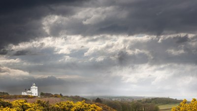
Nor’easters have a particularly destructive impact on coastal communities. The persistent northeast winds push ocean water toward the shore, producing storm surges and high waves that lead to coastal flooding and significant erosion. These effects can be devastating to infrastructure, homes, and ecosystems along the eastern seaboard.
While hurricanes also cause storm surges and coastal flooding, Nor’easters tend to bring prolonged periods of high water due to their slower movement and extended duration near the coast. Additionally, Nor’easters occur in colder months when frozen ground and snowpack complicate drainage, increasing the risk of inland flooding.
Duration and Movement
Nor’easters often last much longer than typical storms, sometimes several days. Their slow movement along the coast allows them to continuously draw moisture and maintain intensity. This prolonged timeframe contributes to heavier snow totals, extended wind damage, and sustained periods of coastal flooding.
In contrast, many mid-latitude cyclones and spring storms pass through an area relatively quickly, causing shorter but sometimes intense periods of precipitation and wind. Hurricanes may be intense but tend to move more rapidly, lessening the duration of their impact in one particular area.
Seasonality and Timing
Nor’easters most commonly occur between late fall and early spring, often peaking in midwinter. This seasonal timing aligns with the presence of cold Arctic air masses, a necessary ingredient for their formation. The influence of Nor’easters on the winter weather patterns of the northeastern US is significant, frequently causing notable snowstorms and coastal flooding events.
Other storms such as tropical cyclones typically occur in warmer months and have very different formation mechanisms tied to oceanic heat. Winter storms in general may occur across many regions, but Nor’easters are particularly linked to the Atlantic coast and cold-weather months.
Geographic Specificity
The geographical characteristics of the northeastern United States and the western Atlantic Ocean basin contribute to the uniqueness of Nor’easters. The coastal plains, peninsula shape, and nearby mountain ranges influence storm track, precipitation distribution, and wind intensity. The presence of the Gulf Stream offshore provides a source of warm moist air, which contrasts sharply with cold continental air, creating dynamic storm systems.
Other storms may affect different regions and lack this precise combination of topography and atmospheric conditions, which makes Nor’easters a distinctive phenomenon largely constrained to the northeastern US coastlines.
Differences From Hurricanes and Other Winter Storms
While both Nor’easters and hurricanes are powerful coastal storms, several differences distinguish them. Hurricanes are tropical cyclones that form over warm ocean waters and require temperatures above 26.5°C (80°F) to develop. They have warm cores and usually dissipate once they move over land or colder water.
Nor’easters, by contrast, are cold-core low-pressure systems associated with frontal boundaries and often form during winter months when cold air masses dominate. Hurricanes typically have a circular eye and symmetrical structure, whereas Nor’easters have more complex shapes and asymmetrical precipitation patterns.
Compared to other generic winter storms, Nor’easters generally produce heavier precipitation, stronger winds, and more prolonged impacts. Many winter storms are smaller scale and shorter lived, lacking the extensive moisture fetch and dynamic wind regimes characteristic of Nor’easters.
Forecasting Challenges
Predicting Nor’easters can be complex due to their interaction of various atmospheric elements such as temperature contrasts, jet stream position, ocean temperatures, and storm track. Small shifts in any of these factors can significantly alter the intensity and impact area of the storm.
Meteorologists use advanced numerical weather models to analyze these components, but challenges remain, especially in determining exact snowfall amounts and differentiating between snow and rain zones near the coast. Despite progress, Nor’easters remain challenging to forecast accurately more than a few days in advance.
Historical Nor’easter Examples
Several Nor’easters have become notable in recent history due to their severity. The Blizzard of 1978 was one of the most intense, dumping over two feet of snow across parts of New England and causing widespread disruption. The storm featured extremely strong northeast winds and paralyzing conditions.
Another example is the 1993 Superstorm, which was an unusually large Nor’easter cross the eastern US and brought snow, rain, and wind over a wide area. Its ability to combine characteristics of a Nor’easter and a tropical system made it unique and highly destructive.
Preparation and Safety Considerations
Residents along the East Coast must take Nor’easters seriously, especially during winter. Preparations include securing property against high winds, stocking emergency supplies in case of power outages, and staying informed about weather updates. Coastal flood zones should have evacuation plans due to the risk of flooding and storm surge.
Unlike some summer storms, Nor’easters require preparedness for a variety of hazards—heavy snow, ice, wind damage, and flooding—which can combine to create dangerous conditions. Local governments also invest in snow removal and emergency response strategies to mitigate the impact during these events.
Environmental and Economic Impact
Nor’easters can cause significant environmental damage including beach erosion, habitat disruption, and contamination of water resources from flooding. Saltwater inundation impacts freshwater ecosystems and agricultural lands, affecting local wildlife and farming communities.
Economically, the storms lead to costly property damage, transportation disruptions, and business closures. The winter tourism industry is sometimes affected as well, with ski resorts either benefiting or suffering depending on snow conditions and access. Recovery efforts after severe Nor’easters often require substantial public and private investment.
Nor’easters stand out as powerful storm systems unique to the northeastern United States during colder months. Their formation relies on the interaction between cold land air and warm ocean air, producing strong northeast winds, heavy precipitation, and prolonged coastal impacts. These features set them apart from hurricanes, other winter storms, and typical mid-latitude cyclones.
Their combination of meteorological characteristics, geographic specificity, and seasonal timing explain why Nor’easters are especially influential in shaping the weather patterns and hazards experienced in this region. Understanding these distinctions is key to forecasting, preparing for, and responding to these formidable storms.