How Weather Satellites Read the Atmosphere From Orbit
Explore the technology and science behind how weather satellites observe Earth's atmosphere from space to forecast weather.
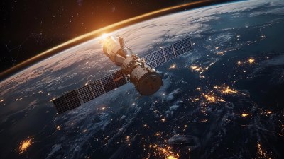
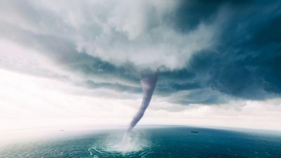
Image by krutarthdabhi1112 on Freepik
Weather satellites play a crucial role in modern meteorology, providing continuous data about the Earth's atmosphere from orbit. These satellites offer a vantage point high above the planet, enabling scientists to monitor weather systems, track storms, and study atmospheric phenomena with unprecedented accuracy and scope. This article delves into the mechanisms and technologies that allow weather satellites to 'read' the atmosphere from space, transforming raw data into actionable weather forecasts and climate analyses.
At the core of weather satellites' capabilities is their suite of remote sensing instruments. Unlike ground-based weather stations, satellites can observe vast areas of the Earth's surface and atmosphere in real-time. Positioned in geostationary or polar orbits, these satellites are equipped with sensors designed to detect various forms of electromagnetic radiation reflected, emitted, or scattered by the atmosphere and surface. By analyzing this radiation, meteorologists extract critical information about temperature, humidity, cloud cover, wind patterns, and more.
Types of Weather Satellites and Their Orbits
Understanding how weather satellites read the atmosphere begins with recognizing their classification and orbital paths. Primarily, there are two main types: geostationary satellites and polar-orbiting satellites.
Geostationary satellites orbit the Earth at approximately 35,786 kilometers above the equator. At this altitude, their orbital period matches the Earth's rotation, allowing them to hover continuously over a fixed geographical area. This steady perspective is invaluable for monitoring weather patterns, especially the development and progression of storms and hurricanes over specific regions.
Polar-orbiting satellites, in contrast, operate at lower altitudes, usually around 700 to 1,000 kilometers. They travel from pole to pole, capturing images and data across the entire globe as the Earth rotates beneath them. This orbit allows the collection of detailed information over all latitudes with higher spatial resolution than geostationary satellites.
Remote Sensing Instruments on Weather Satellites
Weather satellites are outfitted with sophisticated sensors tailored for atmospheric observation. These instruments primarily use passive and active remote sensing techniques.
Passive sensors detect naturally occurring radiation, such as thermal infrared emissions from the Earth's surface and atmosphere or sunlight reflected by clouds and land. Common passive sensors include radiometers, which measure radiation intensity across different wavelengths. By interpreting the spectral signatures, scientists can estimate atmospheric temperature profiles, humidity levels, and the presence of various gases.
Active sensors emit their own signals and measure the return signal reflected by the atmosphere or surface. A prime example is the radar altimeter, which sends radio waves toward Earth and measures the time it takes for the signals to bounce back. While more commonly utilized on other types of satellites, some weather satellites employ active sensors to measure variables such as precipitation intensity and wind speed over the ocean.
How Satellites Measure Atmospheric Parameters
Weather satellites analyze the atmosphere using different observational techniques tied to their sensors:
1. Temperature Profiling: Using infrared and microwave radiometers, satellites detect the intensity of emitted thermal radiation from various atmospheric layers. Each atmospheric layer has a unique temperature, influencing the radiation at specific wavelengths. By capturing signals across multiple wavelengths and atmospheric absorption bands, algorithms reconstruct temperature profiles vertically through the atmosphere.
2. Humidity Measurement: Water vapor absorbs radiation at distinctive frequencies in the microwave and infrared spectrum. Sensors tuned to these frequencies measure water vapor content, producing humidity profiles that help predict precipitation and storm development.
3. Cloud and Precipitation Detection: Visible and infrared imaging instruments observe cloud coverage, types, and heights. Microwave sensors can penetrate clouds to estimate rainfall rates and snowfall. These data improve forecasts concerning storm intensity and movement.
4. Wind Estimation: While satellites cannot directly measure wind speed, they infer surface winds by tracking cloud or water vapor patterns across sequential images. Scatterometers, which emit microwaves and analyze their reflection off ocean surfaces, provide more direct wind vector estimates over seas.
Visible and Infrared Imaging
Visible light sensors onboard satellites capture images much like a camera, but from an orbital vantage. These images show cloud structures, snow cover, ice extent, and land features during daylight. At night, visible sensors are ineffective, but infrared instruments excel by detecting thermal radiance emitted by Earth and its atmosphere, independent of sunlight. This capability allows 24/7 monitoring of weather conditions, revealing cloud top temperatures, sea surface temperatures, and temperature anomalies associated with weather systems.
Microwave Sensing: Peering Through Clouds
One of the most vital tools for atmospheric observation is the microwave sensor. Weather systems are often shrouded by clouds, which obstruct visible and infrared observations. Microwave sensors penetrate these clouds because microwaves have longer wavelengths that are less scattered by cloud particles. This feature permits the measurement of atmospheric moisture and precipitation within and beneath clouds.
Microwave instruments also help retrieve sea surface temperatures and soil moisture levels — critical data for understanding heat exchange processes and drought conditions.
Data Interpretation and Processing
The raw signals received from satellite sensors require complex processing before becoming useful weather information. Ground stations collect the transmitted data and apply algorithms that compensate for atmospheric effects, sensor calibration, and Earth’s curvature.
These algorithms utilize radiative transfer models — mathematical methods describing how radiation passes through and interacts with atmospheric gases and particles. By solving these models inversely, scientists can infer temperature, moisture, and other variables from the measured radiation.
Data assimilation integrates satellite data with information from weather balloons, ground stations, and other satellite systems. This fusion enhances numerical weather prediction models, improving the accuracy and lead time of forecasts.
The Role of Hyperspectral Sounders
Advanced weather satellites carry hyperspectral sounders, which capture thousands of narrow spectral channels across the infrared and visible spectrum. These instruments provide high-resolution vertical profiles of temperature, water vapor, and trace gases, revealing fine-scale atmospheric structures.
Hyperspectral data dramatically improve weather prediction by providing detailed atmospheric layer-by-layer measurements. This granularity helps meteorologists detect phenomena such as temperature inversions and humidity gradients that influence local weather patterns.
Satellite Constellations and Data Refresh Rates
The effectiveness of satellite weather monitoring increases with well-coordinated constellations. Multiple geostationary satellites provide continuous coverage of different continents and oceans, delivering rapid updates typically every 5 to 15 minutes.
Polar-orbiting satellites complement this by offering global snapshots twice daily or more, depending on the number of satellites deployed. Emerging constellations featuring small satellites in low Earth orbit promise even faster refresh rates and more diverse measurements.
Examples of Key Weather Satellite Programs
Several international programs contribute to the global weather satellite network:
NOAA's GOES Series: The Geostationary Operational Environmental Satellites operated by NOAA provide real-time data for North and South America. GOES satellites are equipped with Imager and Advanced Baseline Imager (ABI) instruments capturing multiple spectral bands.
Meteorological Operational Satellite (MetOp): These European satellites operate in polar orbits and carry instruments like the Infrared Atmospheric Sounding Interferometer (IASI) for atmospheric profiling.
Himawari Series: Japanese geostationary satellites provide high-resolution imagery for the Asia-Pacific region.
Suomi NPP: This satellite carries the Visible Infrared Imaging Radiometer Suite (VIIRS), which bridges polar and geostationary satellite functions and supports advanced environmental monitoring.
Applications Beyond Weather Forecasting
While weather prediction is the primary function, satellite atmospheric readings support numerous other applications:
Climate Monitoring: Long-term satellite records track changes in atmospheric composition, cloud cover, and temperature trends critical to understanding climate change.
Disaster Response: Satellites provide early warnings for hurricanes, floods, and wildfires, allowing timely evacuations and preparations.
Environmental Management: Data assist in monitoring air quality, volcanic eruptions, and ozone layer health.
Challenges and Limitations
Despite their capabilities, weather satellites face constraints. Cloud cover can obstruct visible imagery, though other spectral channels mitigate this. Orbital mechanics limit revisit times, particularly for polar orbiters. Sensor calibration and aging impact data quality, requiring continuous validation.
Interpreting complex atmospheric data demands sophisticated modeling and experienced meteorologists. Moreover, geopolitical and funding challenges influence satellite missions and data sharing, affecting global coverage consistency.
Future Developments in Satellite Atmospheric Sensing
Advancements focus on improving spatial and temporal resolution, incorporating artificial intelligence for data analysis, and deploying nanosatellites for dense observational networks. Technological progress in hyperspectral imaging and active sensing promises new insights into atmospheric chemistry and dynamics.
Integration with Earth system models will enhance predictive capabilities from local to global scales, improving preparation for extreme weather events and long-term climate shifts.
In summary, weather satellites are indispensable tools for reading the atmosphere from orbit. By harnessing diverse sensor technologies and complex data processing, they provide vital information that underpins weather forecasting, climate science, and environmental management worldwide.