Warm Fronts Just Want Hugs but Always Get Complicated
Explore the fascinating nature of warm fronts, their formation, effects, and why their interactions become complex.

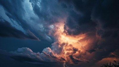
Image created with Flux Schnell
Warm fronts are a fundamental component of Earth’s atmospheric dynamics, playing a crucial role in weather patterns and climatic changes worldwide. Despite their seemingly gentle name, warm fronts often bring about a variety of weather phenomena that can seem complicated to understand. This article delves into what warm fronts are, how they form, the typical weather conditions associated with them, and why their interactions with other air masses and fronts often lead to complex meteorological outcomes.
Understanding Warm Fronts
A warm front occurs when a warm air mass moves toward an area occupied by cooler air. Because warm air is less dense than cold air, it gradually rises over the cooler air, resulting in a specific type of boundary between the two air masses. This boundary is what meteorologists refer to as a warm front. Unlike cold fronts, which typically move faster and have sharper boundaries, warm fronts advance more slowly and with a gentler slope.
The interaction between warm and cold air masses at a warm front leads to the gradual lifting of warm air over cold air, causing clouds and precipitation to form along the frontal boundary. This slow ascent is key to the types of weather often witnessed during warm front passages.
Formation and Movement of Warm Fronts
The genesis of a warm front begins when a warm air mass advances toward a colder region. Such air masses differ significantly in temperature, humidity, and density, which influences their interaction. The cooler air is denser and tends to stay close to the surface, while the warmer, lighter air glides upward above it. As the warm air rises, it cools and condenses, forming clouds and precipitation.
Warm fronts commonly move in cycles connected to larger-scale weather systems, such as mid-latitude cyclones. Often, the warm front is located on the leading edge of these low-pressure systems. The speed of warm fronts is generally slower than that of cold fronts, often moving at a speed of 15 to 25 miles per hour. The slow progression allows for long-lasting weather effects over a region.
Visual and Weather Changes Associated with Warm Fronts
Before the arrival of a warm front, the sky tends to be mostly clear or only partially cloudy with stable conditions. However, as the warm front approaches, a distinct series of clouds typically indicates the impending change in weather. High, thin cirrus clouds form first, progressing to cirrostratus, then altostratus, and finally nimbostratus clouds, which are thick and dark and bring sustained precipitation.
Warm fronts are often associated with steady, moderate rain or drizzle extending over large areas, sometimes lasting for several hours or even days. Because of the gradual slope of the frontal boundary, precipitation occurs over a wide area ahead of the front. Temperatures begin to rise as the front passes, and atmospheric pressure generally decreases before rising again after the front moves through.
The 'Complications' of Warm Fronts
While a warm front’s initial portrayal may seem straightforward, several factors contribute to the complications in their behavior and the weather they produce. First, the contrast between the warm and cold air masses involved can vary widely, altering frontal speed, intensity, and precipitation type. For instance, if the warm air mass is very moist and the cold air below is dry, cloud formation and precipitation can intensify dramatically.
Geography and local topography also affect warm front behavior. Mountains, lakes, and land-water interfaces can influence how warm fronts advance and where precipitation sets in. Warm fronts moving over mountainous terrain can cause orographic lifting, further inducing precipitation and complicating weather predictions.
Additionally, warm fronts often interact with other fronts and atmospheric features, such as cold fronts, occluded fronts, and jet streams. These interactions can intensify storm development or lead to sequences of weather changes that are difficult to forecast accurately. When a warm front overtakes a cold front, an occluded front can form, introducing additional complexities and often resulting in more severe weather.
Impact on Climate and Human Activities
Warm fronts significantly impact regional climate and daily human activities. The gradual temperature rise and increased humidity associated with a warm front can affect agriculture, transportation, and outdoor events. The persistent precipitation often damages crops if it coincides with sensitive growing periods or leads to flooding in vulnerable areas.
Transportation systems, especially aviation and roadways, experience challenges due to the extended periods of low visibility and slick conditions resulting from warm front precipitation. Understanding the timing and progression of warm fronts is essential for efficient planning and response to minimize disruptions.
Scientific Tools to Study Warm Fronts
Meteorologists employ a variety of instruments to study and predict warm fronts. Satellite imagery allows tracking of cloud formations and frontal movements on a broad scale. Radar systems provide data on precipitation intensity and distribution associated with the front. Weather balloons measure temperature, humidity, and pressure profiles vertically through the atmosphere, giving detailed information about the front's structure.
Computer models simulate atmospheric dynamics and forecast the movement and effects of warm fronts. These models incorporate vast amounts of data and physical principles to predict temperature changes, precipitation amounts, and timing, though uncertainties remain due to the complex nature of frontal interactions.
The Metaphorical Warm Front: Warm Fronts 'Wanting Hugs'
The playful notion that warm fronts just want hugs is a metaphor for how warm air masses seek to replace colder air by gently rising over it, akin to an embrace that is initially soft and gradual. However, just like complicated human interactions, warm fronts rarely achieve this transition without causing turbulence or unexpected outcomes. The complexities that arise during their interaction with cold fronts and other weather systems reflect a nuanced dance of physics and atmospheric conditions.
This metaphor also highlights the dual nature of warm fronts: while they bring warmth and often relief from cold temperatures, their passage can also disrupt normal weather patterns and create complications, such as extended wet conditions or storms. Thus, they 'want hugs' in a sense of interaction and replacement but 'get complicated' due to the multifaceted atmospheric processes they trigger.
Case Studies of Notable Warm Front Events
Several historical weather events illustrate the complexity and impact of warm fronts. In the Northeastern United States, slow-moving warm fronts have led to extended periods of rain and flooding, especially in spring and fall seasons. For example, a warm front interacting with a stationary cold front can cause significant rain accumulation over urban areas, overwhelming drainage systems and disrupting daily life.
In Europe, warm fronts associated with Atlantic low-pressure systems bring moist air that raises temperatures and causes prolonged drizzle and fog across wide regions during winter months. These conditions affect airline operations and increase energy demands due to shifts in heating needs.
Warm Fronts and Climate Change
As global temperatures rise, the behaviors of warm fronts may also evolve. Warmer air masses can hold more moisture, potentially increasing precipitation intensity when warm fronts pass. Changes in atmospheric circulation patterns might alter the frequency, speed, and trajectories of warm fronts, impacting regional climates unpredictably.
Researchers continue to study these shifts to better anticipate future weather patterns influenced by climate change. Improved understanding of how warm fronts behave in warming scenarios will be crucial for adaptation strategies in agriculture, infrastructure, and disaster preparedness.
Distinguishing Warm Fronts from Other Fronts
To accurately understand warm fronts, it’s important to distinguish them from other frontal types, including cold fronts, stationary fronts, and occluded fronts. While warm fronts involve warm air advancing over cold air, cold fronts involve cold air pushing beneath warmer air. This difference results in distinct weather patterns—cold fronts often trigger more abrupt and intense weather changes such as thunderstorms, whereas warm fronts tend to bring gradual changes and steady rain.
Stationary fronts occur when neither air mass advances, often causing prolonged cloudy and rainy conditions. Occluded fronts, where a cold front overtakes a warm front, create complex interactions and diverse weather conditions. Knowing these distinctions helps meteorologists predict weather more accurately and communicate effectively with the public.
Future Outlook and Research Directions
Ongoing research in meteorology aims to improve the understanding of warm front dynamics and their broader climatic roles. Advances in remote sensing technology and atmospheric modeling enhance the precision of weather forecasts related to warm fronts. Studying the microphysical processes in clouds formed along warm fronts also contributes to better predictions of precipitation types and amounts.
International collaboration through organizations such as the World Meteorological Organization enables sharing of data and expertise, advancing knowledge globally. Public education about the nature of warm fronts and their weather implications helps communities prepare for and respond to changes effectively.


