The Link Between Atmospheric Layers and Cloud Height
Explore how different atmospheric layers influence cloud heights and their types, crucial for meteorology and climate studies.
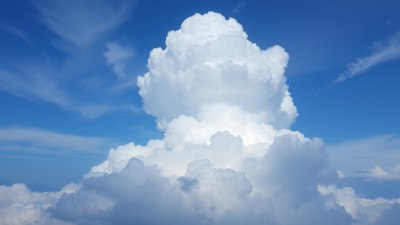
Image created with Flux Schnell
Understanding the link between atmospheric layers and cloud height is fundamental for comprehending weather patterns, forecasting storms, and studying climate dynamics. The atmosphere is divided into several layers, each with distinct characteristics that influence the formation and altitude of clouds. These layers include the troposphere, stratosphere, mesosphere, and beyond, but clouds predominantly form within the troposphere. This article explores how the vertical structure of the atmosphere determines cloud height and categorizes cloud types accordingly.
Atmospheric Layers Overview
The Earth’s atmosphere is composed of several layers characterized by temperature gradients, pressure, and chemical composition. From the surface upwards, the main layers are the troposphere, stratosphere, mesosphere, thermosphere, and exosphere. The troposphere extends from the Earth's surface up to around 8 to 15 kilometers, depending on latitude and weather conditions. This is the layer where nearly all weather phenomena occur, including cloud formation.
Above the troposphere lies the stratosphere, which extends roughly from 15 km to 50 km altitude. This layer is much more stable with temperature increasing with altitude due to ozone absorption of ultraviolet radiation. The mesosphere (50-85 km) and thermosphere (above 85 km) are much less dense and colder, with minimal direct impact on typical weather processes.
The Troposphere: The Primary Zone for Clouds
Clouds are essentially visible collections of water droplets and ice crystals suspended in the air. Their formation depends predominantly on temperature, humidity, and altitude. The troposphere’s decreasing temperature with altitude promotes rising air parcels to cool and condense moisture, forming clouds. Because of this temperature gradient, the troposphere hosts different cloud types at various heights, frequently categorized into low, middle, and high clouds depending on their altitude within the troposphere.
The base and top heights of these clouds vary worldwide due to local atmospheric conditions. For example, in tropical regions, the troposphere extends higher, causing clouds to form higher than in polar areas where the troposphere is shallower.
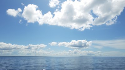
Low Clouds: Surface to Approximately 2 km
Low clouds form from the Earth's surface up to approximately 2 kilometers in altitude. These clouds often consist of water droplets and tend to have significant impacts on weather, especially in terms of visibility and precipitation. Common low clouds include stratus, stratocumulus, and nimbostratus.
Stratus clouds appear as uniform layer clouds often covering the sky like a blanket and can cause overcast conditions without much precipitation. Stratocumulus clouds show patchy, rolled shapes but generally do not produce heavy rain. Nimbostratus clouds, on the other hand, are dark and thick, often associated with continuous precipitation.
Middle Clouds: Approximately 2 to 7 km
Middle clouds typically range from 2,000 to 7,000 meters and are commonly composed of water droplets, though at higher altitudes they frequently include ice crystals. Altostratus and altocumulus fall into this category.
Altostratus clouds usually form a grey or blue-grey layer covering the sky and generally precede steady rain. Altocumulus clouds feature white or grey patches or layers that consist of rounded masses or rolls. Their presence can indicate a change in weather, often signaling approaching thunderstorms if they thicken and lower.
High Clouds: 5 to 13 km
High clouds form at altitudes ranging from approximately 5,000 to 13,000 meters and consist primarily of ice crystals due to the low temperatures at these heights. Types include cirrus, cirrostratus, and cirrocumulus.
Cirrus clouds are thin, wispy strands often seen on fair weather days but can signal changes in weather within 24 hours. Cirrostratus clouds create a translucent veil that may produce halo phenomena around the sun or moon. Cirrocumulus clouds appear as small, white patches or ripples and are less common, indicating moisture at high altitudes.
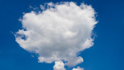
Cumulus Clouds and Vertical Development Across Layers
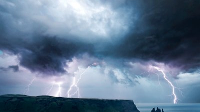
Cumulus clouds often begin as fair-weather clouds at low altitudes but can grow vertically through the troposphere, sometimes reaching the tropopause—the boundary between the troposphere and stratosphere. These clouds can develop into towering cumulonimbus clouds, capable of producing heavy rain, lightning, and severe storms.
The depth of cumulonimbus clouds can range from near the Earth's surface to 12 km or more, depending on atmospheric instability and moisture availability. Their vertical growth is a critical aspect linking atmospheric dynamics and cloud characteristics, as they can penetrate multiple atmospheric sub-layers.
Tropopause and Cloud Height Boundaries
The tropopause, the boundary between the troposphere and stratosphere, acts as a cap on the vertical growth of many clouds. Because the stratosphere is generally warmer and more stable, it limits convection and vertical movement of air parcels. This means most cloud tops do not surpass the tropopause.
Sometimes, powerful cumulonimbus clouds can overshoot the tropopause slightly, injecting water vapor and other compounds into the lower stratosphere. Such phenomena influence upper-atmospheric chemistry and the global climate system.
The Influence of Atmospheric Stability on Cloud Height
Atmospheric stability plays a crucial role in determining cloud height. Stability depends on how temperature changes with altitude and prevalence of moisture. When the atmosphere is unstable, air parcels rise freely, cool adiabatically, and condense moisture, forming deep clouds.
Conversely, stable atmospheres suppress vertical motion, leading to shallow cloud formations and more stratiform clouds. Factors such as surface heating, topography, and frontal movements can alter local stability, thereby influencing cloud height and type.
Special Cloud Types and Atmospheric Layer Relations
Some fascinating cloud types illustrate the interaction with atmospheric layers beyond the troposphere. For example, noctilucent clouds form in the mesosphere at around 80 km altitude. These clouds consist of ice crystals observed during twilight and indicate the upper atmospheric moisture content and temperature.
Another example is contrails, artificial clouds generated by airplanes at high altitudes, often within the lower stratosphere or upper troposphere. Contrails can expand and persist based on humidity and temperature conditions, affecting climate by reflecting sunlight and trapping heat.
Practical Applications of Understanding Cloud Height
Accurate knowledge of cloud height relative to atmospheric layers helps meteorologists improve weather forecasts and climate models. Satellite remote sensing technologies rely on cloud altitude data to interpret atmospheric composition and circulation patterns.
Moreover, aviation benefits from knowing cloud height for safety and flight planning since certain cloud layers are associated with turbulence or icing. Understanding clouds also aids agriculture, hydrology, and disaster management by predicting rainfall and storm development.
Summary of Atmospheric Layers and Their Typical Cloud Heights
To summarize, cloud heights generally correspond to the tropospheric sublayers:
- Low Clouds: Surface to 2 km (stratus, stratocumulus, nimbostratus)
- Middle Clouds: 2-7 km (altostratus, altocumulus)
- High Clouds: 5-13 km (cirrus, cirrostratus, cirrocumulus)
- Vertically Developed Clouds: Surface up to tropopause (~12-15 km) (cumulus, cumulonimbus)
Cloud formations are predominantly confined within the troposphere, influenced strongly by temperature gradients, humidity, and atmospheric stability. The atmospheric layers act as boundaries or zones defining cloud characteristics and heights.
Ongoing Research and Future Perspectives
Scientists continue to study the intricate relationship between atmospheric layers and clouds to improve climate predictions and understand feedback mechanisms. Changes in temperature and moisture distribution due to global warming affect cloud formation, height, and lifetime, influencing the Earth's radiation balance.
Advanced observational techniques, such as lidar, radars, and space-borne sensors, provide high-resolution data on cloud properties and atmospheric conditions. These improve model simulations critical for predicting extreme weather and assessing climate change impacts.
Emerging research focuses on interactions between clouds and aerosols at different altitudes, which modulate cloud microphysics and cloud-related radiation effects. Understanding these processes is vital for developing reliable climate mitigation strategies.
In summary, the relationship between atmospheric layers and cloud height is both complex and crucial for atmospheric sciences. It governs the weather we experience daily and impacts the global climate on longer timescales, making it a key subject of continued research and observation.