The Science of Why It Can Be Too Cold to Snow (Sometimes)
Explore the atmospheric conditions that explain why it can sometimes be too cold to snow, despite freezing temperatures.

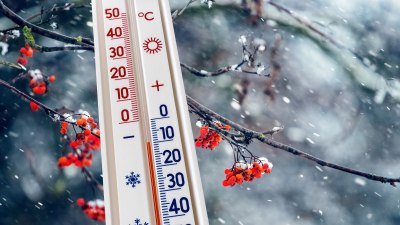
Image created with Flux Schnell
Snow is a common and often beautiful occurrence in many parts of the world, especially during the winter months. It is generally understood that snow forms when the air temperature is below freezing and there is sufficient moisture in the atmosphere. However, a curious phenomenon occurs when it is so cold that it actually inhibits snowfall, leading to the question: why can it sometimes be too cold to snow?
At first glance, the concept seems counterintuitive. One might assume that the colder it is, the more likely snow is to fall, since subfreezing conditions are a prerequisite for snow formation. The reality is more complex, relating to the physical processes of moisture in the atmosphere, the formation of ice crystals, and atmospheric dynamics that govern cloud formation and precipitation.
Basic Principles of Snow Formation
Snow originates from water vapor in the atmosphere. Typically, this water vapor condenses onto microscopic particles called nuclei—such as dust, pollen, or other aerosols—forming ice crystals. When these crystals cluster and grow heavy enough, they fall to the ground as snowflakes.
The critical condition for snow to form is that the temperature within the cloud and the lower atmosphere must be below freezing (0°C or 32°F). However, simply being cold is not enough; there must also be enough moisture to saturate the air and encourage condensation and subsequent ice crystal growth.
Water vapor saturation is described by relative humidity, the ratio of actual moisture content to the maximum possible moisture the air can hold at a given temperature. Warmer air can hold more moisture than cold air, so as temperature drops, the absolute amount of moisture the air can hold also diminishes.
Why Extremely Cold Air Is Typically Very Dry
One of the key reasons it can be too cold to snow is linked to the moisture content of the air. When air temperatures plunge to extremely low levels, the air’s capacity for holding water vapor decreases dramatically. For example, at -20°C (-4°F), the maximum amount of water vapor that air can retain is significantly less than at 0°C (32°F).
This reduction in moisture means that the air often becomes too dry to support the formation of snow. Without sufficient water vapor, ice crystal formation is curtailed, and precipitation of snowflakes is unlikely, even though temperatures are well below freezing.
This phenomenon is why extremely cold regions such as Antarctica or parts of Siberia often experience clear, dry conditions with little snow despite the frigid weather. The dryness is so extreme that these areas are sometimes referred to as deserts because of their low precipitation levels.
Atmospheric Stability and Snowfall
Another factor contributing to the lack of snow in frigid conditions is atmospheric stability. For snow to develop and descend, the atmosphere must be sufficiently unstable to allow air masses to rise. Rising air cools and expands, leading to condensation and cloud formation when moisture is present.
In extremely cold environments, the air tends to be very stable. There is less vertical movement of air masses, making cloud formation scarce. Without clouds rich in moisture, snowfall cannot occur. The stable atmospheric layers inhibit the formation of precipitation-producing clouds.
Supercooled Water Droplets and Ice Nucleation
Snow formation also depends on the presence of ice nucleation particles. In clouds, water droplets can remain liquid even below freezing temperatures; these are called supercooled droplets. Ice nucleation particles trigger these droplets to freeze, initiating the growth of ice crystals.
At very low temperatures, fewer nucleation particles may be effective, and the process becomes inefficient. If there are insufficient or ineffective nucleators, precipitation formation slows down or stops, contributing to the phenomenon of no snow despite cold temperatures.
This mechanism explains why sometimes clouds that appear cold and moist do not produce snow until temperature conditions or particle content change.
Temperature Gradients and Snowfall at the Surface
Another consideration is the temperature profile between the cloud base and ground surface. When snow forms in clouds at altitude, it must fall through layers of air before reaching the ground. These layers might be warmer or drier, causing melting or sublimation of snowflakes before they accumulate.
However, in very cold, dry conditions near the ground, the falling snowflakes may sublimate directly back to vapor, preventing accumulation. This effect is called virga, where precipitation evaporates before it reaches the surface.
Although virga is more common in rain, it can happen with snow during extremely dry winter air masses, reinforcing the idea that snow may not reach the ground despite falling from clouds.
Real-World Examples of Too Cold to Snow
Historical weather observations reveal instances where temperatures have dropped well below zero with little to no snowfall. For example, parts of the Arctic Circle experience frigid conditions during winter months with stagnant air masses and minimal snow.
Similarly, in the mid-latitudes, during polar vortex events or outbreaks of Arctic air, dryness often accompanies extreme cold, leading to frost and ice rather than snow accumulation. In these cases, the air's moisture content is simply too low to maintain snow crystal growth and precipitation.
These examples illustrate how the relationship between cold air and snow is not linear and depends on a combination of atmospheric moisture, temperature profiles, and cloud microphysics.
The Role of Large-Scale Weather Patterns
Large-scale atmospheric patterns also influence whether it can snow during cold spells. For instance, a high-pressure system often brings cold, dry air and clear skies, reducing humidity and inhibiting snowfall.
Conversely, low-pressure systems associated with fronts bring moist, unstable air that can override extreme cold criteria and produce snow. However, if the air mass is extremely cold and dry even within these systems, snowfall may still be scarce.
Therefore, weather patterns and air mass origins play a crucial role in determining the likelihood and amount of snow during cold times.
Understanding Snowfall in Forecasting
Meteorologists must consider these factors when predicting snowfall. Temperature alone is insufficient; atmospheric moisture content, stability, the presence of ice nucleating particles, and vertical temperature profiles are carefully analyzed.
Forecast models incorporate soundings from weather balloons and satellite data to track humidity levels and temperature gradients at various altitudes. This information helps determine whether snowfall is feasible or if conditions are too dry or stable despite cold temperatures.
Impact on Ecosystems and Human Activity
The phenomenon of being too cold to snow has implications beyond theoretical meteorology. Snow cover affects insulation of soil and vegetation, influencing growing seasons and ecosystems. In areas too cold to snow, the absence of snow cover can lead to ground freezing more deeply, impacting plant survival.
For human activity, understanding snowfall patterns affects transportation, agriculture, and energy consumption. Accurate forecasts help prepare for snow events or the lack thereof during periods of extreme cold.
The intricate interplay between temperature, moisture content, atmospheric stability, and microphysical processes explains why it can be too cold to snow at times. Extreme cold reduces the atmosphere's capacity to hold moisture, resulting in dry air unsuitable for snow crystal formation despite freezing conditions.
Stable atmospheric layers restrict cloud development, while limitations in ice nucleation further inhibit precipitation processes. These factors combined clarify the paradox of why frigid conditions do not always produce snowfall. Understanding this complexity enriches our appreciation of weather phenomena and improves forecasting accuracy, providing insight into the broader dynamics of Earth's atmosphere.