How Temperature Gradients Fuel Jet Streams
Explore how temperature gradients drive jet streams, influencing global weather and climate patterns with powerful high-altitude winds.

Jet streams are narrow bands of fast-flowing air found in the upper atmosphere, typically in the tropopause at altitudes between 9 to 16 kilometers (30,000 to 52,000 feet). These powerful winds play a critical role in shaping weather systems and influencing climate patterns worldwide. Understanding how temperature gradients fuel jet streams provides insight into their origin, behavior, and impact on global atmospheric circulation.
Defining Jet Streams and Their Characteristics
Jet streams are characterized by their high wind speeds, usually ranging from 110 to 160 kilometers per hour (70 to 100 miles per hour), though speeds can exceed 400 kilometers per hour in some cases. These winds flow predominantly from west to east, encircling the globe in the mid-latitudes. Their position and velocity can vary seasonally and due to other atmospheric conditions.
The Role of Temperature Gradients in Atmospheric Circulation
Temperature gradients occur when there is a difference in temperature between adjacent regions of the atmosphere. These gradients create pressure differences due to the expansion and contraction of air masses, initiating atmospheric motion. On a large scale, the primary temperature gradient influencing jet streams exists between the equator and the poles. The equatorial regions receive more direct solar energy, leading to warmer temperatures, whereas the polar regions remain colder due to lower solar insolation.
This latitudinal temperature difference produces a gradient that generates significant changes in air pressure. Warmer air near the equator expands and rises, creating lower pressure at the surface, while colder air near the poles contracts and sinks, creating higher surface pressure. This pressure disparity sets the foundation for large-scale wind patterns, including the westerlies and easterlies, and ultimately the formation of jet streams.
The Thermal Wind Relationship: Connecting Temperature Gradients and Wind Shear
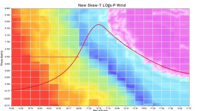
One of the fundamental principles explaining how temperature gradients fuel jet streams is the thermal wind relationship. This meteorological concept relates the change in wind speed with height (wind shear) to the horizontal temperature gradient. In essence, when there is a horizontal temperature difference, the vertical change in wind velocity increases, producing strong winds aloft.
At the surface, winds tend to be weaker due to friction and reduced pressure gradients. However, as altitude increases, frictional effects lessen, and the temperature gradient becomes more pronounced, causing the wind to accelerate with height. The thermal wind relationship mathematically expresses that the vertical shear of the geostrophic wind is proportional to the horizontal temperature gradient:
∂V_g/∂z ∝ -∂T/∂x
where V_g represents the geostrophic wind and T the temperature. This means that stronger temperature differences across latitudes produce larger increases in wind speed at higher altitudes, leading to the formation of jet streams.
Formation of the Polar and Subtropical Jet Streams
There are two main jet streams in each hemisphere: the polar jet stream and the subtropical jet stream, both driven largely by temperature gradients.
Polar Jet Stream: The polar jet stream forms near the tropopause at latitudes around 50 to 60 degrees. It arises primarily because of the steep temperature gradient between cold polar air masses and warmer mid-latitude air. This strong contrast, especially during winter, creates significant wind shear at upper levels, generating a swift, narrow jet stream.
Subtropical Jet Stream: The subtropical jet stream occurs closer to 30 degrees latitude, affected by temperature contrasts between tropical air and the warmer mid-latitudes. While the temperature gradient here is less intense than near the poles, it still generates high-altitude winds through similar thermal wind mechanisms.
Seasonal Variations in Temperature Gradients and Jet Stream Behavior
Temperature gradients fluctuate seasonally, and so do jet streams. During winter, especially in the Northern Hemisphere, the pole is much colder relative to the equator, intensifying the temperature gradient. This strengthens the polar jet stream, making it faster and more defined. Conversely, in summer, the temperature difference diminishes, resulting in a weaker, more meandering jet stream.
These seasonal changes influence weather patterns substantially. In winter, a stronger jet stream tends to steer storms and cold air masses, while in summer, weaker jets allow warmer air masses to migrate, providing more stable weather in some regions.
Jet Stream Meandering: The Influence of Temperature Gradient Variations
The jet stream does not flow in a straight line but instead exhibits waves or meanders, known as Rossby waves. These oscillations form due to variations in temperature gradients, Earth’s rotation (Coriolis effect), and the distribution of landmasses and oceans. As the jet stream meanders, it can cause alternating regions of high and low pressure, leading to weather phenomena such as cold snaps, heat waves, or prolonged precipitation.
Impact of Temperature Gradient Changes Due to Climate Change
Climate change is expected to alter temperature gradients globally by warming the poles faster than the equator, a phenomenon called Arctic amplification. This reduces the temperature difference between the poles and lower latitudes, potentially weakening the polar jet stream. A weaker jet stream may lead to more persistent weather patterns, such as prolonged heatwaves or cold spells, as its meanders become more pronounced and slower-moving.
Research continues on how these changes may affect jet stream dynamics long term, with implications for weather predictability and climate models worldwide.
How Temperature Gradients Drive Jet Streams
In summary, jet streams are fueled by temperature gradients between different latitudinal zones. These gradients produce pressure differences that drive winds at high altitudes. The thermal wind relationship explains how horizontal temperature differences translate to vertical wind shear, intensifying winds in the upper atmosphere. Seasonal variations in temperature gradients cause corresponding shifts in jet stream strength and position, impacting weather and climate globally.
Ongoing changes in Earth's temperature distribution due to human activities suggest that jet streams may behave differently in the future, altering established patterns of atmospheric circulation and weather events.
Understanding the fundamental role of temperature gradients in jet stream formation is essential for meteorology, climate science, and preparing for shifts in regional and global weather behavior.


