Why Clouds Form in Parallel Lines Over Oceans
Explore the scientific reasons behind the formation of parallel line clouds over oceans and the atmospheric conditions that cause this phenomenon.
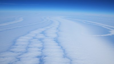
Image created with Flux Schnell
When observing the vast expanse of the world's oceans from high altitudes or satellite images, one can often notice a striking natural pattern: clouds aligned in nearly perfect parallel lines stretching across the horizon. This intriguing phenomenon has fascinated meteorologists, pilots, and oceanographers alike. Understanding why clouds form in such organized parallel lines over oceans involves exploring the interplay of atmospheric dynamics, oceanic influences, and weather patterns.
Cloud formation fundamentally requires moisture, rising warm air, and cooler temperatures at higher altitudes to condense water vapor into visible droplets. Over the oceans, the abundant moisture source sets the stage, but it is the atmospheric and oceanic forces that shape these clouds into parallel lines.
Role of Atmospheric Waves in Cloud Patterns
One of the primary drivers behind regularly spaced parallel cloud formations are atmospheric gravity waves. These waves occur when the stable stratified atmosphere is disturbed, causing air parcels to oscillate vertically as they propagate horizontally, much like waves on a water surface. In particular, when wind flows over oceanic waves or coastal mountains, it can generate atmospheric gravity waves that travel downwind.
As the air is forced upward along the crest of these waves, the moist air cools and condenses, forming clouds. On the troughs or downward parts of the wave, the air descends, warms, and evaporates the clouds. This cycle of lifting and subsiding creates bands of cloud separated by clear air, resulting in the characteristic parallel strips seen from satellite imagery. These repeating wave patterns can extend for hundreds of kilometers, emphasizing their scale and the organized nature of cloud formation in these situations.
Interactions Between Sea Surface and Atmospheric Conditions
Besides atmospheric waves, the sea surface itself plays an important role in forming linear clouds. The temperature of the sea surface can vary in patches, producing differences in the heat and moisture supplied to the overlying atmosphere. Ocean currents, upwelling zones, and temperature fronts can create linear zones of enhanced evaporation. When these moist, warm air masses rise, they form clouds aligned with the oceanic features below.
Additionally, the ocean surface's friction affects near-surface winds, contributing to patterns in wind speed and direction that help organize cloud formations. These wind shifts can concentrate clouds into elongated lines parallel to the wind flow.
Impact of Atmospheric Stability and Shear
Atmospheric stability is a crucial factor. When the lower atmosphere is stable, vertical motion is suppressed except where an external force, like a gravity wave, forces the air upward. This leads to well-defined, thin cloud bands instead of broad, fluffy clouds spread over the sky. Stability limits the vertical extent of clouds, causing them to spread laterally in patterns that often align with the prevailing wind flow.
Wind shear, the change in wind speed or direction with height, also contributes by stretching cloud bands into narrow, parallel lines. Horizontal wind shear can organize clouds by eroding clouds in certain areas while enhancing their formation in others, sharpening the boundaries between cloud bands.
Trade Winds and the Formation of Cloud Streets
In tropical and subtropical oceanic regions, the persistent trade winds blowing from east to west generate another type of parallel cloud formation known as cloud streets. These are rows of cumulus clouds formed over the ocean due to convection combined with wind shear and roll vortices—rotating tubes of air aligned with the wind direction.
Cloud streets typically appear as rows of cumulus clouds separated by cloud-free lanes and can extend for hundreds of kilometers. They result from organized convection where warm, moist air rising in one part of the vortex creates a cloud, while descending air in adjacent areas leads to clear spaces.
Satellite Observations and Climate Implications
Satellite imagery has been invaluable in studying parallel cloud formations over oceans. By providing a bird’s eye view, satellites reveal the extent, spacing, and movement of cloud bands. This data helps scientists understand atmospheric wave dynamics and the influence of ocean-atmosphere interaction on weather and climate.
These cloud patterns can influence the radiation balance of the Earth, reflecting sunlight back to space and impacting local temperatures. Understanding how and when these parallel cloud lines form can refine weather prediction models, particularly in forecasting cloud cover and precipitation over oceans, which are often data-sparse regions.
Case Examples of Parallel Cloud Line Formation
One well-documented example is cloud streets over the North Atlantic Ocean during cooler months when the air above the relatively warmer ocean surface becomes unstable. Similarly, over the west coasts of continents where cold offshore currents induce strong temperature gradients, parallel lines of stratocumulus clouds are commonly observed.
Another interesting phenomenon is the formation of bands of clouds stemming from island wake effects. When wind flows past an island, it can produce atmospheric waves and vortices downstream, leading to parallel cloud lines in the lee of the island.
Role of Oceanic Upwelling Zones
Areas of oceanic upwelling, where deep, colder water rises to the surface, cool the sea surface temperature locally. This cooling can stabilize the lower atmosphere, suppressing broad cloud formation but enhancing narrow, linear cloud bands aligned with the coastline and prevailing winds. These regions are hotspots for cloud formation in parallel lines due to sharp temperature gradients and steady wind flow.
Additional Factors Influencing Cloud Line Formation
Besides the main drivers mentioned above, several other factors can influence the formation and persistence of clouds in parallel lines over oceans. These include variations in humidity, the presence of aerosols acting as cloud condensation nuclei, and diurnal cycles that regulate heating and cooling patterns.
Moreover, synoptic-scale weather patterns, such as high-pressure systems, can stabilize the atmosphere and promote the development of these distinct cloud formations by channeling airflow and suppressing convection in non-organized areas.
Comparison with Parallel Cloud Lines Over Land
While parallel cloud lines are most famously observed over oceans, similar patterns can form over land under the right conditions. However, over land, terrain irregularities, variable surface heating, and more turbulent boundary layers usually disrupt these patterns, making linear cloud bands less persistent and less extensive.
Ocean surfaces provide a relatively uniform and expansive environment, which allows atmospheric waves and airflow patterns to maintain coherence over long distances, favoring the orderly pattern formation of parallel clouds.
Practical Implications and Observations
Understanding why clouds form in parallel lines over oceans has practical applications in aviation, maritime operations, and weather forecasting. Pilots often use these cloud bands as visual cues for atmospheric stability or turbulence. Similarly, weather forecasters analyze these formations to predict cloud cover, wind patterns, and potential precipitation.
Furthermore, the distinct appearance of these cloud lines in satellite imagery aids meteorologists in identifying atmospheric waves and stability conditions, helping in the interpretation of larger scale weather systems.
In summary, the formation of clouds in parallel lines over oceans results from a combination of atmospheric gravity waves, stable atmospheric conditions, shear in the wind, ocean surface temperature variations, and organized convection patterns such as trade wind rolls. These factors work together to produce narrow, well-defined cloud bands aligned with prevailing winds, visible from both the ground and space.
The continual study of these formations enhances our understanding of atmospheric dynamics, improves weather prediction models, and reveals the complex interactions between the ocean and atmosphere that govern Earth’s climate system.