Why Storm Clouds Look So Flat on the Bottom
Discover the reasons behind the flat bottoms of storm clouds and the atmospheric science explaining this natural phenomenon.
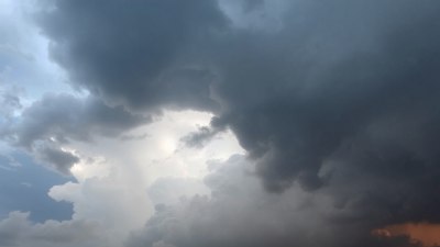
Image created with Flux Schnell
Storm clouds often captivate observers not only with their imposing size and dark, brooding appearance but also with an intriguing feature: their flat bottoms. This characteristic flatness is a common sight in cumulonimbus clouds, the type typically associated with storms, but it often sparks curiosity. Why do these storm clouds have such distinctly flat bases? The answer lies in the atmospheric conditions and physics that govern cloud formation and development.
Understanding Cloud Formation
To comprehend why storm clouds have flat bottoms, it’s essential to understand how clouds form. Clouds develop from water vapor in the air. Warm air near the surface rises, carrying moisture upward. As this air ascends, it cools due to the decrease in temperature with altitude, a process known as adiabatic cooling. Cooling reduces the air’s capacity to hold moisture, meaning excess water vapor begins to condense into tiny water droplets or ice crystals, forming a cloud.
The altitude at which this condensation begins is critical. It is known as the lifting condensation level (LCL). The LCL marks the height where the relative humidity reaches 100%, causing the water vapor to start transitioning into liquid droplets. This level forms the apparent 'bottom' of the cloud because below this height, the air is generally clear, and above it, the air is saturated and full of visible moisture.
The Role of the Lifting Condensation Level
The LCL is a crucial factor in shaping the flat base of storm clouds. It is determined primarily by the temperature and moisture content of the air near the ground. For instance, on a warm, humid day, the LCL is relatively high because the air needs to rise more before cooling to its dew point. Conversely, on cooler or drier days, the LCL is lower, meaning clouds appear closer to the ground.
Because the air tends to reach its dew point nearly uniformly across a large area, the cloud base tends to form at roughly the same altitude, resulting in a flat cloud bottom. This phenomenon explains why storm clouds, which form by strong rising warm air currents, display such a consistent, flat underside despite their often chaotic and turbulent upper areas.
The Vertical Development of Cumulonimbus Clouds
Storm clouds are predominantly cumulonimbus clouds, known for their impressive vertical growth that can reach high into the atmosphere. Once air parcels pass the LCL and condensation begins, latent heat is released as water vapor condenses into droplets. This heat release warms the air parcel further, making it buoyant and causing it to rise rapidly through the surrounding cooler air.
This powerful updraft results in the cloud tower extending upward, often reaching the tropopause, the boundary between the troposphere and stratosphere. While the base remains fixed at the LCL, the cloud’s top grows dramatically, leading to the classic anvil-shaped upper portion of storm clouds often seen in weather photography and observations.
Factors Influencing Cloud Base Flatness
Though the flatness of storm cloud bottoms is predominantly due to the LCL, several factors can influence the exact appearance and elevation of the cloud base. These include:
- Humidity Levels: Higher moisture content in the air lowers the LCL, bringing the cloud base closer to the ground.
- Surface Temperature: Warmer surface temperatures increase the altitude of the LCL.
- Air Stability: Stable atmospheric layers can cap vertical air movement, affecting cloud vertical development but often not changing the flat base significantly.
- Topography: Terrain can affect rising air currents, sometimes leading to localized differences in cloud base height.
Visual Illusions and Perceptions
The flat cloud base can sometimes appear more dramatic than it really is due to perspective and lighting conditions. From the ground looking up, the uniformity of the base creates a sharp boundary that accentuates the flatness. Lighting from the sun, shadowing, and contrast with the sky can further enhance this effect.
Additionally, the tops of storm clouds are much less uniform than the base. Strong winds at higher altitudes shape the upper parts into varied, often fibrous or anvil forms that contrast sharply with the flat base, reinforcing the perception of a clearly defined lower edge.
The Science Behind the Dew Point and Its Relationship to Clouds
At the heart of why cloud bottoms are flat lies the relationship between air temperature and dew point temperature. The dew point is the temperature to which air must be cooled for saturation to occur, meaning the air reaches 100% relative humidity, and condensation begins.
When warm air rises, it cools at a predictable rate (the dry adiabatic lapse rate until saturation is reached, then the moist adiabatic lapse rate afterward). The altitude where the air temperature equals the dew point is the LCL, marking the height where clouds form. Because the environmental factors (temperature and humidity) tend to change gradually over distances rather than abruptly, the LCL tends to be relatively uniform in a given area, causing the uniform flat base.
Variations in Cloud Base Flatness
Despite the general tendency for storm cloud bases to be flat, certain conditions can cause variations or irregularities. For example, if the humidity near the surface varies significantly across different locations, the LCL and thus the cloud base altitude will differ, producing clouds with more uneven bottoms.
Localized updrafts or downdrafts can also result in slight variations in cloud base height. Additionally, the presence of dust, pollutants, or other particulates can influence condensation and cloud formation, subtly affecting the cloud bottom's shape.
Storm Clouds and Weather Prediction
The characteristic flat base of storm clouds is more than an aesthetic feature; it provides valuable clues to meteorologists. By observing the cloud base, weather professionals can estimate the LCL, which aids in assessing atmospheric moisture content and the potential for storm development. A low cloud base often indicates high moisture and potential for severe weather phenomena such as heavy rain, hail, or tornadoes.
In aviation, cloud base height is also critically important for flight safety. Pilots need accurate cloud base data to ensure visibility and to plan approaches and landings accordingly.
The Interaction of Physics and Atmosphere
The flat bottoms of storm clouds are a visible testimony to the interaction between atmospheric physics and observable weather phenomena. They arise from the consistent altitude where air reaches the dew point and condensation begins, forming a stable cloud base. The towering vertical development that leads to storms and severe weather occurs above this base, creating dramatic and dynamic cloud structures.
Next time you gaze up at a thunderstorm brewing on the horizon, remember that the striking flatness of its cloud base is a natural indicator of complex atmospheric processes. This thin line between clear air and saturated cloud symbolizes the invisible forces that shape our weather daily.