Why Jet Streams Get Wild in the Winter Months
Explore why jet streams become erratic during winter, impacting weather patterns globally with intense storms and cold spells.
Jet streams are powerful, narrow bands of strong wind flowing from west to east high in the atmosphere, typically found around the tropopause, the boundary between the troposphere and stratosphere. These high-altitude ribbons of air shape weather patterns and influence climate conditions across the globe. Their behavior is dynamic and varies seasonally, often becoming notably more erratic and intense during the winter months. Understanding why jet streams get wild in winter involves delving into atmospheric dynamics, temperature contrasts, and the physics underpinning their formation and movement.
The jet streams primarily originate due to the temperature differences between tropic and polar air masses. During the winter, the contrast between the cold polar air and the relatively warmer air of lower latitudes becomes more pronounced. This steep temperature gradient intensifies the pressure differences and accelerates the winds, resulting in stronger and more vigorous jet streams. In essence, the greater the temperature contrast across latitudes, the more powerful and erratic the jet stream tends to be.
One of the most important jet streams is the polar jet stream, which flows around the mid to high latitudes and is directly influenced by the seasonal temperature shifts. In winter, the polar regions cool substantially, while equatorial and subtropical regions remain comparatively warm. This creates a steep thermal gradient that strengthens the polar jet. The stronger jet stream can develop sharp undulations called Rossby waves - large meanders in the course of the jet that transport warm air poleward and cold air equatorward.
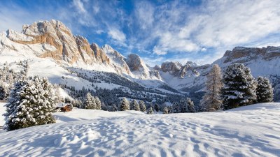
Rossby waves play a crucial role in the wildness of winter jet streams. The waves are amplified when the jet stream strengthens in response to the amplified temperature gradient in winter. These amplified waves cause the jet stream to meander more dramatically, producing sharp north-south dips and ridges. Such oscillations allow frigid Arctic air to plunge southward, triggering cold snaps and blizzards in mid-latitude regions while allowing milder air masses to move northward. This dynamic interaction between air masses leads to highly variable and extreme winter weather patterns.
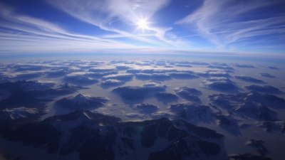
Another factor influencing the jet stream's behavior in winter is the presence of Arctic air and polar vortices. The polar vortex is a large area of low pressure and cold air surrounding the poles that strengthens in the winter due to the lack of solar heating. When strong, it helps confine cold air to polar regions, fostering a relatively stable jet stream path. However, when the polar vortex weakens or distorts due to atmospheric disturbances, cold polar air can escape farther south, breaking the jet stream’s linear flow and causing wild shifts. These shifts often correspond to prolonged cold waves or unusual warmth depending on the geographic location.
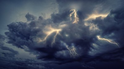
Additionally, winter conditions enhance the interaction between the jet stream and weather systems such as storms and cyclones. The jet stream acts as a steering mechanism for these systems, and when it behaves erratically, it can lead to unusual storm tracks and intensification. A stronger and more wavy jet stream can encourage the deepening of extratropical cyclones, leading to severe winter storms or nor’easters along the US East Coast and comparable severe weather in other parts of the world.
Topography also influences jet stream behavior. Mountain ranges such as the Rockies and the Himalayas can disrupt airflow, causing the jet stream to split, slow down, or change direction. During winter, these effects can become more pronounced because the jet is stronger and more sensitive to environmental obstacles. For example, the Rocky Mountains can cause a split in the jet stream, creating two branches - one flowing southward and one northward - enhancing regional weather variability and sometimes resulting in cold air plunging into the central United States.
The ocean also plays a vital role in modulating the jet stream during winter. Sea surface temperatures can influence atmospheric pressure systems, indirectly impacting the jet stream. Phenomena such as El Niño and La Niña, phases of the El Niño-Southern Oscillation, cause shifts in tropical Pacific ocean temperatures, which subsequently alter atmospheric circulation patterns globally. During El Niño winters, the jet stream over North America tends to be more zonal and strong, often resulting in milder, wetter conditions in the southern US, while La Niña winters exhibit a more amplified jet stream and colder northern climates.
Climate change is increasingly affecting the jet stream’s winter activity. As the Arctic warms faster than the mid-latitudes – a phenomenon known as Arctic amplification – the temperature gradient that drives the jet stream weakens. Some scientists theorize this weakening gradient might lead to slower-moving and more persistent jet stream patterns, which can cause prolonged cold spells or heat waves. However, other research indicates that the jet’s behavior might become more extreme and variable, depending on specific conditions and regional impacts of climate change.
Climate models suggest that due to Arctic warming, the jet stream might adopt a more meandering pattern with larger Rossby waves that linger longer over regions. This stagnation can exacerbate the severity and duration of extreme weather events during winter, such as extended cold outbreaks or unseasonably warm periods. In this way, the jet stream’s winter wildness may not just become more intense but also less predictable, complicating seasonal weather forecasting.
Winter jet streams also influence aviation and atmospheric pollution dispersion. Strong and fluctuating jet streams affect flight routes, increasing turbulence and impacting fuel efficiency for long-haul flights. Additionally, their pattern directs the movement and mixing of pollutants on a continental scale, influencing air quality during winter months. Sudden shifts and enhancements in jet stream strength therefore have both environmental and economic implications beyond just weather.
Observations of the jet stream in winter have increasingly relied on satellite data and advanced atmospheric models. These tools allow meteorologists to observe wind speeds at different altitudes and predict jet stream paths several days in advance with increasing accuracy. However, the complex interplay of thermal gradients, topography, and climate variability still poses challenges to fully understanding and forecasting the jet stream’s winter behavior.
Various studies have emphasized the importance of the polar jet in generating and sustaining winter weather systems across North America, Europe, and Asia. In North America, the jet stream’s position strongly influences the development of cold air masses and storm tracks that bring snow and freezing rain. Similarly, in Europe and Asia, shifts in the jet stream are linked to bouts of cold Siberian winds or mild Atlantic air incursions, shaping distinct winter climates and anomalies.
Forecasting the jet stream's winter variations remains critical for anticipating natural hazards such as ice storms, Arctic outbreaks, and flooding from winter cyclones. Emergency preparedness agencies rely on understanding jet stream dynamics to warn populations of adverse weather conditions that could impact transportation, energy supply, and public safety. With increasing extreme weather events potentially influenced by wild jet stream patterns, enhancing forecast accuracy for this upper-atmosphere phenomenon is a priority for meteorological research.
In summary, the winter months bring a unique set of atmospheric circumstances that cause jet streams to become stronger, more erratic, and impactful. The pronounced temperature contrasts between polar and tropical air masses amplify wind speeds, increasing jet stream strength. This leads to amplified Rossby waves that induce dramatic meanders, influencing cold air outbreaks and storm development. Arctic vortex dynamics, oceanic patterns, and topographical disruptions further modulate the jet stream’s winter behavior. Current climate shifts appear to be modifying these patterns, potentially making jet streams even wilder. Through ongoing research and improved modeling, scientists aim to deepen understanding of these upper-level winds that dictate much of the winter weather experienced worldwide.