What Weather Radar Echoes Mean to Meteorologists
Explore how meteorologists interpret weather radar echoes to understand precipitation and storm dynamics.
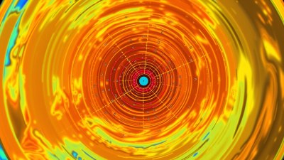
Weather radar echoes are a crucial tool for meteorologists to observe and analyze various atmospheric phenomena. These echoes are essentially signals bounced back from objects such as raindrops, snowflakes, hail, and even sometimes birds or insects. By interpreting these radar returns, meteorologists can deduce important information about precipitation type, intensity, location, and storm development, allowing for timely weather forecasts and warnings.
At the core of weather radar technology lies the transmission and reception of radio waves. A radar system sends short pulses of microwave energy into the atmosphere. When these pulses encounter precipitation particles, a portion of the energy is reflected back to the radar antenna; this reflected signal is known as an echo. The strength and timing of this returned echo enable meteorologists to estimate the distance and concentration of precipitation.
The strength of a radar echo, commonly referred to as reflectivity, is one of the primary characteristics meteorologists analyze. Reflectivity is measured in decibels relative to Z (dBZ) and gives an indication of the density and size of precipitation particles. Higher dBZ values generally correspond to heavier precipitation. For instance, light rain may produce reflectivity values between 15 and 30 dBZ, while intense rain or hail can exceed 60 dBZ. This helps meteorologists estimate rainfall rates and identify severe weather conditions.
Radar echoes also provide information about the shape and type of precipitation. Different hydrometeors reflect radar waves differently due to their size, shape, and water content. Raindrops produce relatively uniform echoes, while hailstones can cause very strong, often irregular reflectivity returns. Snowflakes typically produce weaker echoes, since snow is less dense and has a more complex structure, resulting in lower reflectivity values. By analyzing the reflectivity patterns and associated weather conditions, meteorologists classify precipitation type, which is essential for accurate forecasting.
In addition to reflectivity, Doppler radar technology measures the velocity of precipitation particles toward or away from the radar site by detecting frequency shifts in the returned signal. This Doppler velocity data is critical for assessing wind patterns within storms. Strong inbound or outbound velocities may indicate rotating updrafts in supercell thunderstorms, which could potentially spawn tornadoes. Such velocity signatures are invaluable for early severe weather warnings and real-time storm tracking.
Weather radar systems commonly present their data in visual formats such as reflectivity maps, velocity maps, and spectrum width imagery. Reflectivity maps show precipitation intensities and locations, allowing meteorologists to identify rain bands, hail cores, and storm structure. Velocity maps reveal wind movement, helping to detect rotation or wind shear. Spectrum width describes the diversity of velocities within the radar volume and can be used to distinguish turbulent areas from more stable regions.
Radar data analysis also plays an important role in hydrology and flood forecasting. By estimating rainfall over a watershed, meteorologists can model runoff and anticipate flooding risks. Radar-derived rainfall estimates are especially helpful in regions lacking dense networks of rain gauges. During tropical cyclones or severe storms, radar offers continuous monitoring of precipitation distribution and intensity, guiding emergency response efforts.
Interpreting radar echoes requires skill and experience, as non-meteorological targets can sometimes create ambiguous signals. For example, ground clutter—unwanted echoes from buildings, terrain, or even birds—can obscure true weather signals. Meteorologists use filtering techniques, multiple radar sites, and situational awareness to discern genuine precipitation from noise. Moreover, dual-polarization radar technology, which transmits and receives both horizontal and vertical wave pulses, enhances object identification by providing more detailed information about particle shape and size, further refining precipitation classification.
Beyond precipitation, radar echoes can reveal other atmospheric phenomena such as wind shear zones, microbursts, and mesoscale convective systems. Studying echo patterns over time allows meteorologists to understand storm evolution and predict changes. For instance, radar can detect storm cell splitting or merging, which affects storm intensity and movement. Tracking echo tops—the highest altitude where radar detects precipitation—provides insight into storm vertical development, critical for anticipating severe weather.
Weather radar technology has evolved significantly since its introduction during World War II. Modern Doppler radars scan the atmosphere rapidly and at multiple elevation angles, building a three-dimensional picture of precipitation and wind fields. Networks of radars across countries enhance spatial coverage, crucial during widespread weather events. Continuous upgrades in radar signal processing, resolution, and polarization capabilities improve accuracy and reliability.
Advanced radar data assimilation into numerical weather prediction models enhances short-term forecasts and nowcasting. By feeding radar-derived precipitation and velocity data into models, meteorologists improve simulation of storm intensity, track, and rainfall distribution. This integration supports emergency management decisions, aviation safety, and public warnings.
As climate patterns shift and extreme weather frequencies rise, the importance of radar echoes in meteorology grows. Rapid, detailed observations support timely preventative measures and mitigation strategies. Researchers continue to explore novel radar applications such as dual-frequency radar and machine learning techniques for automated echo classification and storm prediction.
In summary, weather radar echoes offer meteorologists a dynamic window into atmospheric processes. From identifying precipitation type and intensity to detecting storm rotation and wind patterns, echoes inform critical weather assessments. Interpreting these signals with precision supports effective forecasting, public safety, and scientific understanding of the atmosphere.
The physical principles underlying radar echoes are intimately linked with electromagnetic wave behavior and meteorological conditions. Electromagnetic pulses at microwave frequencies propagate through the atmosphere, scattering off particles back to the radar. Factors such as particle concentration, shape, dielectric constant, and size distribution influence the magnitude of the returned signal. Understanding these interactions helps meteorologists decode what the radar echoes represent.
Furthermore, radar beam characteristics affect echo interpretation. As radar beams spread with distance and scan upward at various elevation angles, target volume and sampling geometry change. Beam widening causes spatial averaging of reflectivity values, which may reduce detail at far ranges. Thus, meteorologists must consider beam height and radar horizon when analyzing echoes for accurate assessment.
Radar system limitations also influence echo interpretation. Attenuation—signal weakening by heavy precipitation or obstacles—can reduce echo intensity, masking storm cores or hail. Anomalous propagation, where radar beams bend due to atmospheric ducting, may introduce false echoes. Overcoming these challenges requires comprehensive metadata analysis, cross-referencing with other observation systems like satellites and surface stations.
Integration of weather radar data with other meteorological tools enhances overall understanding. Satellite imagery provides broad-scale cloud and moisture context, while surface observations confirm radar indications of precipitation type and temperature. Radiosonde profiles offer vertical atmospheric structure to aid interpretation of radar-based rainfall estimation and storm dynamics. This multi-sensor approach improves forecast accuracy and situational awareness.
Training and expertise remain vital in interpreting weather radar echoes effectively. Meteorologists undergo rigorous education to learn radar principles, signal processing, and pattern recognition. Operational experience in diverse meteorological environments hones their ability to distinguish real weather events from false echoes and noise. Continuous professional development ensures adaptation to emerging radar technologies and evolving weather challenges.
Public dissemination of radar data also plays a key role in raising awareness and safety. Many weather forecasting services provide radar images and animations online and through mobile applications, enabling users to track storms in real-time. Clear interpretation and communication of radar information assist communities in making informed decisions about travel, outdoor activities, and severe weather sheltering.
Ultimately, radar echo interpretation is a blend of physics, technology, and meteorological knowledge that equips meteorologists to decode the often complex signals returned by the atmosphere. These insights into precipitation and atmospheric motion are fundamental to weather forecasting, disaster preparedness, and advancing meteorological science.
As new radar innovations emerge, such as phased-array systems capable of faster scans and new wavelength bands targeting specific precipitation types, the scope of echo analysis will continue to expand. This progress promises even greater resolution and lead time for severe weather alerts, further safeguarding lives and property.
