What the Term “Wind Shear” Really Means in Storm Forecasting
Discover the true meaning of wind shear and its critical role in storm forecasting and severe weather prediction.
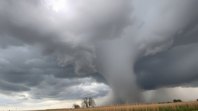
Image created with Flux Schnell
Understanding the atmosphere's complexities is crucial for meteorologists, especially when predicting severe weather events like thunderstorms, tornadoes, and hurricanes. One vital term frequently heard in storm forecasting discussions is "wind shear." But what does "wind shear" really mean, and why is it so important in weather prediction? This article explores the concept of wind shear, how it's measured, and its significant influence on storm development and behavior.
Defining Wind Shear
Wind shear refers to the variation in wind speed and/or direction over a short distance in the atmosphere. This change can occur horizontally or vertically. Simply put, wind shear describes how the wind shifts as you move from one point to another either across the surface or upwards through the atmosphere.
For example, if the wind at ground level is calm but intensifies rapidly to strong winds at higher altitudes, this describes vertical wind shear. Alternatively, if winds change direction or speed substantially across a horizontal distance, such as from one side of a storm front to the other, this is horizontal wind shear.
Types of Wind Shear
Wind shear is primarily classified into two categories: horizontal and vertical.
Horizontal Wind Shear: This occurs when wind speed or direction varies across a horizontal line, such as across the passage of a weather front or near the boundary between different air masses. Horizontal shear can influence surface weather phenomena, like dust devils or localized gusts.
Vertical Wind Shear: More critical in storm forecasting, vertical shear involves wind changes with height. For example, winds might be light and from the southeast near the surface but strong and from the west higher up. This vertical gradient impacts thunderstorm dynamics, influencing their structure, longevity, and severity.
Measuring Wind Shear
Meteorologists measure wind shear using data from weather balloons, Doppler radar, and wind profilers. Weather balloons, or radiosondes, carry instruments up through the atmosphere, recording wind speed and direction at various levels. Analyzing the difference between these levels gives insights into the vertical shear profile.
Doppler radar, especially mobile and phased array systems, provide real-time wind measurements within storms, revealing areas of strong shear that can favor tornado development or storm rotation. Wind profilers, stationary radar instruments measuring winds at multiple atmospheric levels, help monitor shear patterns continuously.
Wind Shear and Thunderstorm Formation
One of the most significant impacts of wind shear pertains to thunderstorms. Vertical wind shear affects storm organization, rotation, and intensity. In a low-shear environment, thunderstorms tend to be short-lived and relatively weak, often described as pulse storms that develop and dissipate quickly.
However, when appreciable vertical wind shear exists, thunderstorms can become more organized and longer-lasting. This happens because the difference in wind speed and direction at different altitudes creates a tilting effect on the storm’s updrafts. Rather than the updrafts collapsing upon their own downdrafts, the tilting separates the inflow of warm, moist air from the downdrafts, allowing the storm to sustain itself for a longer period.
Wind Shear and Supercell Storms
If vertical wind shear is strong and particularly when the wind veers (turns clockwise) with height, it can generate rotating thunderstorms called supercells. Supercells are unique because they contain a persistent rotating updraft, known as a mesocyclone.
The rotation arises partly because the horizontal wind shear causes horizontal spinning air tubes near the surface, which the storm’s updrafts then tilt into the vertical. This rotation intensifies the storm, often leading to severe weather phenomena like large hail, damaging winds, and tornadoes.
Wind Shear's Role in Tornado Formation
Wind shear is a fundamental ingredient in tornado genesis. Tornadoes typically develop from supercells with strong mesocyclones. The presence of substantial vertical wind shear allows an environment where horizontal vortices form near the surface and are then tilted and stretched by the storm's updraft into vertical rotating columns.
These rotating columns can tighten and intensify, leading to the formation of a tornado. Without adequate shear, the rotational structure needed for tornadogenesis would be insufficient or absent.
Wind Shear in Hurricane Environments
While wind shear fosters rotating thunderstorms, it works differently with tropical cyclones like hurricanes. Hurricanes thrive in environments with low vertical wind shear because strong shear can disrupt their warm, moist core structure.
High wind shear displaces the thunderstorms from the circulation center, weakening the storm. Conversely, low wind shear enables the cyclone’s vertical column to remain intact, promoting intensification. Forecasters monitor wind shear carefully to assess a storm's potential to strengthen or weaken.
Wind Shear and Aviation Safety
Beyond storm forecasting, wind shear is critical for aviators. Sudden changes in wind speed and direction near airports can be dangerous during takeoff and landing. Microbursts and gust fronts — phenomena related to localized wind shear — can cause rapid shifts in aerodynamic forces on an aircraft.
To mitigate these hazards, airports employ wind shear detection systems, and pilots receive training to recognize and respond appropriately to wind shear encounters.
Forecasting Wind Shear
Meteorologists use numerical weather prediction models that simulate the atmosphere to forecast wind shear. These models analyze patterns of temperature, pressure, humidity, and wind at various altitudes to estimate where significant shear may occur.
Additionally, understanding synoptic weather patterns, such as jet streams and fronts, helps forecasters anticipate zones of strong wind shear. Weather balloons and remote sensing data provide real-time shear observations that are essential to refining these forecasts.
Wind Shear Indices and Parameters
To quantify wind shear’s impact, meteorologists use several parameters and indices. One common measure is the Bulk Shear, which calculates the vector difference in wind between two atmospheric levels, often between the surface and 6 km altitude.
Other indices like the Storm Relative Helicity (SRH) evaluate the potential for rotating updrafts by considering the wind shear and storm motion. Higher SRH values indicate a greater likelihood for supercell formation and tornado potential.
Real-World Examples of Wind Shear Impact
Numerous severe weather events highlight wind shear's crucial role. For instance, the 2011 Super Outbreak in the United States saw strong wind shear environments that supported an unprecedented number of violent tornadoes across multiple states.
Similarly, the intensification and track of hurricanes such as Katrina (2005) were influenced significantly by shear patterns, which dictated their strengthening or weakening phases.
Misconceptions About Wind Shear
Some people mistakenly think wind shear simply means stronger winds, but it really refers to changes in wind speed or direction over distance. Gentle winds can still produce strong shear if there's a rapid directional shift.
Also, not all wind shear leads to severe weather — its impact depends on other atmospheric factors such as moisture, instability, and lift, which together create the conditions for storms to develop.
Wind shear is a fundamental atmospheric feature that shapes how storms develop, evolve, and dissipate. Its presence or absence can determine whether a thunderstorm lasts minutes or hours, or whether it produces severe hail, damaging winds, or tornadoes.
Recognizing and measuring wind shear allows meteorologists to better predict hazardous weather and issue timely warnings, saving lives and property. For pilots and aviation professionals, understanding wind shear is essential for aviation safety.
In essence, wind shear is a key to decoding the complex behaviors of the atmosphere, making it indispensable in modern storm forecasting.