What Causes Virga and Why It Doesn’t Reach the Ground
Discover the science behind virga—rain that evaporates before reaching the ground—and the atmospheric conditions that create this fascinating weather phenomenon.
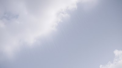
Image created with Flux Schnell
Virga is an intriguing meteorological phenomenon where precipitation falls from a cloud but evaporates or sublimates before reaching the ground, resulting in streaks or shafts of rain or snow visible beneath the cloud but never touching the earth. This striking visual phenomenon often leaves observers curious about what causes it and why the precipitation seemingly vanishes midair. Understanding virga involves exploring atmospheric physics, moisture content, temperature profiles, and other environmental factors.
To grasp why virga occurs, it is essential first to understand how precipitation forms and falls through the atmosphere. Typically, clouds develop when moist air rises and cools, causing water vapor to condense into liquid droplets or ice crystals. As these particles collide and coalesce, they grow heavy enough to fall as precipitation—rain, snow, sleet, or hail depending on temperature conditions. However, as this precipitation falls through different layers of the atmosphere, its fate depends heavily on the humidity and temperature encountered along the way.
Virga commonly occurs in arid or semi-arid regions but can also be observed in more humid settings under specific atmospheric conditions. The defining characteristic is a dry layer beneath the cloud base. When precipitation emerges from the cloud, it encounters a pocket of air that is significantly drier than the saturated air within the cloud. In this unsaturated lower layer, the falling precipitation begins to evaporate or sublimate, turning back into water vapor or ice without reaching the surface. This process is similar to droplets evaporating after a rain shower ends, but it happens continuously in the air during virga events.
The key driver behind virga formation is the vertical structure of moisture in the atmosphere. Meteorologists often represent this moisture stratification using a sounding—a vertical profile of temperature, humidity, and pressure captured by radiosonde balloons. When the sounding reveals a dry sub-cloud layer, the likelihood of virga increases. The unsaturated air below the cloud base causes precipitation particles to lose mass as they descend, and if this layer is deep or dry enough, no precipitation will survive to the surface.
In addition to moisture, temperature plays a critical role. Temperature affects the rate of evaporation and sublimation. Warmer temperatures in the dry sub-cloud layer accelerate evaporation of raindrops, while colder temperatures can cause ice crystals or snowflakes to sublimate directly into vapor. Wind also influences virga’s appearance and behavior by dispersing evaporated moisture and sometimes creating visually captivating streaks that fan out or twist as they descend.
Virga is often observed during light to moderate precipitation events rather than heavy downpours. Heavy rain can saturate the lower atmosphere quickly, reducing evaporation and allowing precipitation to reach the ground. In contrast, light precipitation in a dry environment provides just enough precipitation to form visible shafts but insufficient to saturate the dry air completely. This balance results in the characteristic streaking effect of virga.
Scientific research indicates that virga has notable ecological and meteorological implications. One important effect is its capacity to impact surface-level moisture availability and weather forecasts. Areas experiencing virga might receive little to no wetting rain despite cloudy and rainy conditions aloft, which can complicate water management, agriculture, and drought assessments. Furthermore, virga can influence atmospheric stability and temperature profiles through evaporative cooling: as precipitation evaporates, it absorbs heat from the surrounding air, leading to cooling of the lower atmosphere. This cooling can contribute to downdrafts or even microbursts, sudden and intense downward wind gusts that can pose hazards to aviation and ground activities.
Virga also plays a role in cloud physics and precipitation processes. When precipitation evaporates midair, it affects the microphysical evolution of clouds by removing particles or altering humidity levels near the cloud base. This feedback mechanism can affect cloud lifetime and dynamics, sometimes suppressing further precipitation formation. Observations and model studies help scientists better understand these interactions and improve weather prediction accuracy, especially in regions prone to virga.
From a visual perspective, virga provides stunning scenes. It can appear as wispy tails hanging from clouds, sometimes shimmering in the sunlight or capturing hues from sunsets and sunrises. Virga is particularly common beneath altostratus, cirrostratus, and cumulonimbus clouds. Pilots often use virga as an indicator of changing weather conditions or potential turbulence. The existence of virga can signal dry air entrainment into storm systems, which might weaken or modify precipitation strength.
In summary, virga forms because falling precipitation encounters dry air below the cloud base, causing it to evaporate or sublimate before reaching the ground. Factors such as moisture stratification, temperature, wind, and precipitation intensity dictate whether precipitation will survive its descent or vanish into vapor. Understanding virga enriches our appreciation for the complexity of atmospheric processes and highlights the delicate interplay between moisture and temperature in our weather systems.
The study of virga dates back to the early days of meteorology but has advanced significantly with modern technology. Remote sensing tools, such as weather radar and lidar, allow scientists to detect virga layers and analyze precipitation behavior aloft. These technologies complement traditional instruments like radiosondes and surface observation stations. Together, they provide a comprehensive picture of atmospheric conditions contributing to virga formation. Such data enhances numerical weather prediction models that guide forecasters and inform decision-making in sectors reliant on precise weather knowledge.
Climate change may also indirectly affect virga frequency and characteristics by altering atmospheric moisture patterns and temperature gradients. Changing rainfall regimes combined with shifts in atmospheric stability might increase or reduce conditions favorable for virga development in certain regions. Ongoing research investigates how climate variability influences virga and related precipitation phenomena, with important implications for water resources planning and atmospheric science.
Notably, virga can also occur with snow or ice precipitation, known as snow virga or ice virga. In cold climates or at higher altitudes, ice crystals that fall from clouds can sublimate in dry air, producing distinct visual effects similar to rain virga. These forms pose similar challenges in forecasting snowfall accumulation and understanding cloud microphysics. They further exemplify the diverse manifestations of virga across weather types and geographic locations.
Observing virga is easier during specific times and conditions. Clear visibility, low winds, and well-developed cloud layers with precipitation increase the chances of witnessing this phenomenon. Photographers and weather enthusiasts often seek out virga images due to their dramatic appearance. Scientific expeditions might target virga zones to sample aerosol and humidity profiles or study atmospheric turbulence. Such research deepens insights into boundary layer processes and cloud-environment interactions.
The educational value of virga extends to increasing public awareness of how dynamic and layered our atmosphere is. What looks like simple falling rain can hide complex transformations before affecting the surface environment. Virga reminds us that clouds and precipitation are influenced by vertical gradients and often non-intuitive processes. Engaging students and the public with virga demonstrations fosters curiosity about weather science and nature’s subtle details.
In meteorological literature, virga is often classified among precipitation anomalies since it represents precipitation formation without resultant surface accumulation. It sits alongside other phenomena such as drizzle, mist, and fog that challenge straightforward interpretations of atmospheric moisture. Virga challenges observers' expectations that rain always wets the ground, illustrating how intermediate atmospheric processes alter weather outcomes. This complexity makes it a topic of interest from basic physical principles to applied hydrology and climatology.
Virga is a fascinating weather feature caused by precipitation evaporating or sublimating in dry air layers before reaching the ground. Influenced by moisture profiles, temperature, wind, and precipitation intensity, virga provides valuable insights into atmospheric structure and dynamics. It has implications for weather prediction, climate studies, ecological balance, and safety in aviation. Its ethereal appearance also enriches the natural spectacle of the sky, highlighting the continuous interplay of physics and environment above us.