What Causes Sudden Wind Shifts Before a Storm
Explore the atmospheric dynamics and causes behind sudden wind shifts before storms in this detailed explanation.

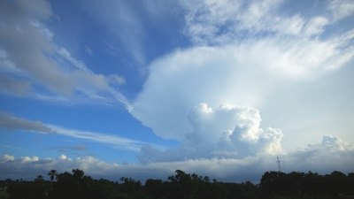
Sudden wind shifts before a storm are a common yet intriguing meteorological phenomenon that often signal the approach of severe weather. These abrupt changes in wind direction and speed can range from a gentle breeze pivoting to a strong gust from a new direction, startling observers and sometimes serving as critical early warnings for imminent storms.
Understanding the causes behind these rapid wind changes requires delving into the complex interplay of atmospheric forces and structures, including pressure gradients, temperature contrasts, frontal boundaries, and storm dynamics. In this article, we detail the scientific explanations behind sudden wind shifts before a storm, exploring the relevant meteorological principles and practical implications.
Atmospheric Pressure and Wind Patterns
Wind is essentially the movement of air from areas of higher pressure to areas of lower pressure. The greater the pressure difference between two areas, the stronger the wind that blows. Storms often produce rapidly evolving pressure systems that lead to sudden shifts in wind direction and intensity. Before a storm arrives, the local pressure field changes as the storm’s center approaches, altering the pressure gradients around a location. These shifting gradients cause winds to realign abruptly as air moves to balance the pressure disparities.
For example, a low-pressure system approaching from the west will cause winds at a given location to begin blowing from the east, then gradually veer toward the north and eventually to the west as the center of low pressure passes. The timing and magnitude of these shifts depend on the storm's strength, speed, and structure.
Role of Frontal Boundaries
Frontal boundaries are zones where two air masses of differing temperatures and humidity levels meet. These fronts are common catalysts for storms and produce notable changes in weather conditions, including wind shifts. When a cold front approaches, it pushes under the warmer air, forcing the warm air upward and often triggering precipitation and storms.
As the cold front nears, winds typically shift suddenly from a southerly or southeasterly direction to a more westerly or northwesterly direction. This sharp shift happens because the cold, dense air mass behind the front advances rapidly, replacing the warmer air and changing the pressure gradient. Observers near the front often feel a gust front, where strong winds blast ahead of the storm and abruptly change the local wind direction. This phenomenon is a key indicator of an impending storm.
Outflow Boundaries and Gust Fronts
Before or during thunderstorms, cold downdrafts of air descend to the ground, spreading out horizontally as they hit the surface. This spreading out creates outflow boundaries or gust fronts, which act much like mini cold fronts. These gust fronts push the warmer surface air upward and can cause sudden, sometimes violent, shifts in wind direction and speed.
When an outflow boundary passes through a location, the wind can change direction abruptly and increase in speed, often accompanied by a noticeable temperature drop. Multiple outflow boundaries from different storms can interact, causing more complex wind patterns and multiple shifts.
Temperature Gradients and Wind Shear
The difference in temperature across a region can create gradients that influence wind direction and speed. Before a storm, rapid cooling from precipitation or shading can cause local temperature drops that affect nearby wind patterns. Temperature gradients can enhance localized pressure differences, initiating sudden directional changes of wind.
Wind shear, which is the change in wind speed or direction with height, is also significant near storms. Though wind shear refers to vertical variations in wind, it can manifest near the surface as sudden shifts if mixing brings down air from aloft. For example, when storm downdrafts reach the surface, they can transport winds from higher levels that differ markedly in direction and speed. This process results in sudden gusts with changed wind directions.
Influence of Topography
Local topography can amplify or alter wind patterns considerably, especially during pre-storm conditions. Hills, valleys, and urban landscapes force air to funnel, rise, or change direction. These effects can make sudden wind shifts more pronounced or abrupt as the storm approaches.
For instance, winds may accelerate as they squeeze through narrow valleys and then suddenly turn as they exit. This can coincide with the arrival of a storm's leading edge or gust front, causing notable shifts in wind behavior due to both meteorological and terrain-driven factors.
Storm-Scale Atmospheric Circulations
On a microscale, storms produce their own circulations, including mesocyclones, inflow, and downdraft patterns, that influence wind directions locally. The inflow region of a thunderstorm typically has winds directed toward the storm, while outflow regions push winds outward. A sudden switch from inflow to outflow winds leads to stark directional changes near the storm’s perimeter.
Additionally, large convective cells can develop rotational patterns, resulting in localized wind shifts before severe weather arrives. These storm-scale circulations evolve quickly, contributing to the often sudden wind shifts noticed by observers.
Examples of Sudden Wind Shifts Before Different Storm Types
Different types of storms display characteristic wind shift patterns before arrival, shaped by their unique formations and dynamics.
Thunderstorms: Often produce gust fronts and outflow boundaries. Winds may shift from calm or southerly to strong gusts from the northwest or west, sometimes accompanied by temperature drops and humidity changes.
Tornadoes: Exhibit rapid directional shifts in low-level winds, especially near the circulation center. Sudden veering or backing of winds at the surface can portend tornado genesis.
Hurricanes: Cause gradual to abrupt wind shifts as the eye wall approaches and passes. Winds typically veer clockwise in the Northern Hemisphere, changing from onshore to offshore directions.
Practical Importance of Sudden Wind Shifts in Weather Forecasting
Meteorologists monitor wind shifts carefully as indicators of approaching storms and their severity. Sudden changes in wind direction and speed provide information about frontal passages, gust fronts, and storm intensity. Radar observations complemented by surface wind data help forecasters predict severe weather, issue warnings, and advise public safety measures.
In aviation and maritime operations, sudden wind shifts can affect takeoffs, landings, and navigation. Pilots and sailors rely on wind information to adjust procedures and maintain safety, especially when storms are imminent.
Summary of Atmospheric Causes Behind Sudden Wind Shifts
Sudden wind shifts before a storm arise from several interacting atmospheric mechanisms:
- Changing pressure gradients due to approaching low-pressure systems
- Frontal boundaries displacing air masses with different temperature and density
- Outflow boundaries and gust fronts from thunderstorm downdrafts
- Temperature gradients altering localized winds
- Vertical wind shear mixing air layers
- Topographic influences shaping wind flow patterns
- Storm-scale circulations like mesocyclones and inflow/outflow zones
Each factor plays a role in generating the dynamic and often sudden changes in wind direction and intensity before storms, combining to create the characteristic pre-storm wind shifts familiar to many weather watchers.
By observing these shifts and understanding their causes, individuals and meteorologists alike can better anticipate storm arrival and severity, enhancing preparedness for severe weather impacts.