What Causes a Line of Storms to Bow Out
Understand the meteorological factors that cause a line of storms to bow out, leading to intense weather events.
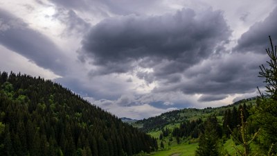
Storms are among the most powerful and captivating natural phenomena, often displaying complex and dynamic structures. One fascinating feature observed in certain storm systems, particularly squall lines, is the phenomenon of "bowing out." But what causes a line of storms to bow out? This article delves into the meteorological dynamics behind bowing segments in storm lines, explaining the physical processes, atmospheric conditions, and implications for severe weather events.
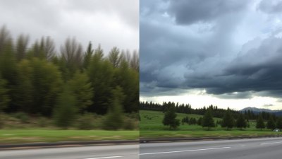
A line of storms, often called a squall line, is a continuous or segmented band of thunderstorms. These lines are typically associated with cold fronts or other converging air masses, and they can stretch for hundreds of miles across a region. Squall lines produce a variety of weather effects, including heavy rain, strong winds, hail, and occasionally tornadoes. Observing from radar or satellite imagery, one might notice sections where the storm line visibly "bows" outward. This bow-shaped protrusion is not only a distinctive shape but also a signal of powerful wind activity. To understand why this occurs, we need to examine the interaction between storm-scale winds and atmospheric forces.
Structure of a Squall Line
Squall lines typically consist of numerous individual storm cells arranged in a more or less linear configuration. These cells form along a boundary where warm, moist air meets cooler air, creating conditions conducive to thunderstorm development. Within a squall line, the storms can be organized into different zones: a leading convective line ahead of a trailing stratiform precipitation region, and individual cells at various life stages.
The dynamics within a squall line are highly dependent on balance between updrafts (rising air that fuels the storm) and downdrafts (descending chilled air). A bowing segment often indicates a localized intensification of the system, with a particular area pushing outward ahead of the main line due to enhanced winds associated with downdrafts.
Role of Rear-Inflow Jet
One of the key factors responsible for the bowing out of a storm line is the development of a rear-inflow jet. This is a relatively fast-moving stream of air that penetrates the storm from behind, flowing into the mid-levels of the system. The rear-inflow jet is driven by pressure gradients created within and around the convective line, and it often carries dry, cooler air from behind the storm mass.
As the rear-inflow jet accelerates, it enhances downdrafts near the surface, pushing out the rain-cooled air and generating strong, straight-line winds that surge ahead of the squall line. This surge of wind lifts and bends the storm line forward, creating the distinct bow shape visible on radar. These winds can cause damage comparable to that of a tornado, but over a broader area, and are a hallmark characteristic of bow echo storms.
Microphysical Processes Affecting Bowing
Besides the dynamics of inflow and outflow, the microphysics inside the storm also contribute to bow formation. The evaporation of precipitation particles within the downdraft cools the air, making it denser and thus heavier. This enhanced downdraft accelerates the outflow winds at the surface. The stronger the downdraft, the more pronounced the bowing because the pressure gradient increases, leading to stronger pushing of the front edge of the line.
Environmental Wind Shear
Wind shear, the change in wind speed or direction with height, is fundamental in shaping squall lines and their bowing segments. Moderate to strong wind shear supports the organization of storms into lines and promotes sustained storm longevity. When wind shear is well-aligned with the squall line orientation, it can foster the development of rear-inflow jets. This shear helps channel momentum from upper levels down to the surface, intensifying the outflow winds that cause bowing.
Role of Cold Pool Dynamics
Cold pools are regions of cooler air generated by evaporative cooling beneath storms, often found trailing behind squall lines. The behavior of cold pools is fundamental to bow echo formation. As cold pools propagate along or ahead of the convective line, they interact with the environmental flow and buoyancy of warm air. If a cold pool moves faster than the ambient wind, it can force the storm line to surge forward locally, driving the bow outward.
Similarly, when a stronger cold pool lifts warm, moist air ahead of it more efficiently, it can intensify the storms in that segment, further pushing the bow outward due to enhanced updraft strength and precipitation loading. The balance between cold pool speed and the environmental winds is a critical factor in determining whether a bow echo forms and how pronounced it will be.
Influence of Terrain and Boundaries
Physical features and atmospheric boundaries also influence how squall lines bow. Terrain can channel wind flows or disrupt storm propagation, creating localized zones of enhanced wind or storm development. Boundaries such as outflow boundaries from previous storms, sea breezes, or drylines can supply additional lift or modify wind shear, affecting how a squall line bows at certain points. These conditions can lead to the formation of mesoscale low-pressure areas that help foster bowing behavior.
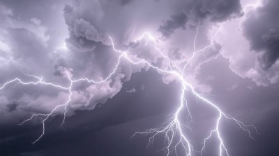
Hazards Associated with Bow Echoes
The bowing segments of squall lines are closely associated with severe weather hazards. The strong straight-line winds produced by rear-inflow jets can cause widespread damage, injuring people and damaging infrastructure such as power lines, trees, and buildings. While bow echoes primarily produce straight-line winds, tornadoes can occasionally form near the apex of the bow where wind shear and storm rotation are enhanced.
Because bow echoes can move rapidly and produce significant wind damage over large areas, they are a major concern for storm spotters, emergency services, and meteorologists. Early recognition of a bowing segment via radar and observation is crucial to issuing timely warnings and protecting life and property.
Radar Identification of Bowing Lines
Modern radar technology is vital for identifying bowing segments within squall lines. On radar reflectivity images, bow echoes appear as curved segments bulging outward from the main linear structure. The shape is caused by the accelerated movement of the central part of the line compared to the ends, reflecting the presence of strong winds pushing the convective line forward.
Velocity data from Doppler radar helps confirm the presence of the rear-inflow jet and strong winds associated with the bow. Meteorologists watch for rapid changes in velocity fields near the bow apex, which indicate intensification of low-level winds. These radar signatures allow forecasters to distinguish bow echoes from other storm types and issue appropriate severe weather warnings.
Case Studies of Notable Bow Echo Events
Historical storm events provide valuable insights into bow echo dynamics and their impacts. For example, the April 3-4, 1974 Oklahoma City tornado outbreak featured squall lines with pronounced bows that generated devastating straight-line winds and multiple tornadoes. Another significant event was the May 8, 2009 derecho event across the Mid-Atlantic and Ohio Valley, where bow echoes propelled damaging winds over a vast area.
These real-world examples demonstrate how a combination of atmospheric instability, wind shear, and cold pool dynamics can produce violent weather when squall lines bow out. Studying such cases helps refine forecasting techniques and improve public safety messaging.
How Storm Modelers Simulate Bow Echoes
Weather modeling has advanced significantly to simulate and predict bow echo formation. High-resolution numerical models incorporate detailed physics of convection, wind shear, and microphysical processes, allowing researchers to recreate bow echo phenomena in computer simulations. By adjusting environmental parameters such as wind profiles and moisture content, models reveal the conditions favorable for bowing and help test hypotheses about underlying mechanisms.
Better simulation of bow echoes improves operational forecasts and warnings by providing probabilistic information about the likelihood of severe wind events associated with bowing squall lines.
Interaction with Larger Weather Systems
Squall lines and their bowing segments do not exist in isolation; they often embed within larger synoptic weather systems like frontal zones and jet streams. The larger-scale environment can modulate the intensity and movement of bow echoes. For instance, the presence of a strong low-level jet stream can enhance moisture convergence and wind shear, fueling bowing storms. Conversely, subsidence behind cold fronts can stabilize the atmosphere and limit bow echo formation.
Understanding how mesoscale bow echoes fit into the broader weather context informs accurate forecasting and hazard assessment.
Summary of Causes Behind Storm Line Bowing
In essence, a line of storms bows out because of localized intensification resulting from interactions between rear-inflow jets, cold pool dynamics, wind shear, and microphysical cooling processes. These factors combine to produce accelerated outflow winds that push segments of the storm line forward, creating the characteristic bow shape. Environmental boundaries and terrain can further influence this pattern, while radar observations provide vital clues for identification and warning.
The bowing out of storm lines signals high wind potential and necessitates vigilance to mitigate risks. Recognizing the meteorological underpinnings of bow echoes enhances our capability to anticipate severe weather and better protect communities.
Continued research and improved observation technology promise to deepen understanding of these remarkable storm features and ultimately reduce their societal impacts.