How Weather Models Handle High-Altitude Data
Explore the methods and techniques weather models use to process high-altitude atmospheric data for accurate forecasting.

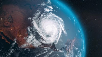
Weather prediction relies heavily on a vast amount of data collected from various altitudes of the atmosphere. High-altitude data, typically gathered from satellites, weather balloons, and aircraft, provide essential information about atmospheric conditions above the surface. These data are crucial for understanding and forecasting weather patterns since many critical weather processes develop or have precursors at these elevated layers.
High-altitude atmospheric data include parameters such as temperature, humidity, pressure, wind speed, and wind direction measured at different pressure levels, from the near-surface to the stratosphere. Incorporating this vertical profile into numerical weather prediction (NWP) models enhances forecast accuracy by informing the evolving state of the atmosphere.
Sources of High-Altitude Atmospheric Data
Before delving into how weather models handle this data, it's important to recognize the primary sources of high-altitude atmospheric observations:
- Weather Balloons (Radiosondes): These are launched twice daily in many locations worldwide and provide profiles of temperature, humidity, and pressure up to about 30 km altitude. They offer vertical atmospheric data with high resolution.
- Satellites: Geostationary and polar-orbiting satellites carry radiometers and other instruments that infer atmospheric parameters indirectly. GPS Radio Occultation, for example, uses satellite signals to produce high-vertical-resolution profiles of temperature and moisture.
- Aircraft Observations: Commercial and research flights provide in-situ measurements at flight altitudes (typically between 8 km and 12 km). These observations fill critical gaps over oceans and remote regions.
- Remote Sensing Instruments: Ground-based lidars and radars can measure winds and humidity in the troposphere and lower stratosphere, supplementing high-altitude data.
Each of these data sources has particular strengths and limitations in spatial and temporal coverage, precision, and latency. Weather models must combine these heterogeneous observations efficiently to exploit their complementary information.
Data Assimilation: The Foundation for Using High-Altitude Observations
Weather models start by creating an initial atmospheric state known as the analysis. This analysis blends observational data with the model's previous forecast (background) using data assimilation techniques. Assimilation is particularly challenging for high-altitude data due to sparse coverage and the complexities of atmospheric dynamics at these elevations.
Common assimilation methods include variational techniques such as 3D-Var and 4D-Var, and ensemble-based methods like the Ensemble Kalman Filter (EnKF). These methods work by minimizing the difference between model forecasts and observations while considering their respective uncertainties.
In the high-altitude context, where data are often indirect (e.g., satellite radiances), advanced observation operators are employed. These mathematical transformations convert model variables into quantities comparable to observations, allowing assimilation algorithms to integrate these data correctly.
The assimilation system must address issues such as representativeness errors and observation biases, which can be more pronounced at high altitudes due to atmospheric variability and measurement characteristics. Bias correction procedures are routinely applied to reduce systemic errors, ensuring more reliable assimilation.
Vertical Coordinate Systems in Weather Models
To represent the atmosphere numerically, NWP models discretize it into vertical layers using coordinate systems that handle altitude-related data effectively. Common choices include pressure, sigma (terrain-following), hybrid sigma-pressure, and isentropic coordinates.
Many modern global models use hybrid vertical coordinates that combine terrain-following layers near the surface with pressure-based layers aloft. This setup improves model stability and physical realism while allowing flexible representation of high-altitude atmospheric structures.
Accurate representation of vertical gradients in temperature, humidity, and wind is essential for modeling phenomena such as jet streams, tropopause folds, and stratospheric intrusions. Models with sufficiently fine vertical resolution in the upper troposphere and lower stratosphere capture these features, enabling assimilation systems to integrate high-altitude data more effectively.
Physical Parameterizations Affecting High-Altitude Forecasts
Physical parameterizations within NWP models describe processes unresolved at the grid scale, such as radiation, cloud microphysics, and turbulence. Many of these influence atmospheric conditions even at high altitudes.
Radiation Schemes: Solar and terrestrial radiation interactions are modeled carefully since they significantly affect temperature profiles in the stratosphere and mesosphere. Radiative heating and cooling impact circulation patterns and the overall energy budget.
Cloud and Convection: While deep convection predominantly occurs in the troposphere, its influence extends upward through heating and momentum transport. Models simulate convective processes to replicate their upward impact on the atmosphere.
Turbulence and Gravity Waves: Parameterizations of turbulence and gravity waves are vital for representing momentum transport and mixing in the upper troposphere and lower stratosphere, affecting wind and temperature fields.
By incorporating high-altitude observational data into these physical schemes, models improve their representation of upper-atmospheric dynamics and thermodynamics, leading to better forecasts including jet stream position, storm development, and upper-level troughs and ridges.
Challenges Posed by High-Altitude Data Integration
Despite the availability of multiple high-altitude data sources, integrating these into weather prediction models presents several challenges:
- Sparse Coverage: Remote oceanic and polar regions have fewer balloon launches and aircraft measurements, leading to observational gaps. Satellite data help mitigate this but come with their own challenges.
- Indirect Measurements: Satellite instruments often measure radiances, which require complex retrieval algorithms and can be influenced by clouds, aerosols, or surface properties, introducing uncertainties.
- Instrument Biases and Calibration: Varying sensors and methodologies may have biases that need careful correction to prevent them from degrading model analysis quality.
- Temporal Resolution: Some high-altitude data sets, like radiosondes, are only available a few times a day, while conditions can evolve rapidly.
Weather models and assimilation systems must implement advanced error modeling and quality control techniques to handle these issues effectively.
Numerical Weather Prediction Models and High-Altitude Forecasting
Different models have their methods and resolutions impacting how high-altitude data are utilized:
Global Models: Examples include the ECMWF Integrated Forecast System, GFS, and UK Met Office Unified Model. These employ wide-ranging data assimilation systems combined with robust vertical coordinate schemes and physical parameterizations. They ingest satellite radiances, radiosondes, and aircraft data to forecast large-scale patterns including upper-level jet streams and stratospheric events.
Mesoscale and Regional Models: While focused on lower-atmosphere scales, these models integrate high-altitude boundary conditions from global model outputs. Some advanced regional models assimilate high-altitude aircraft data and satellite information to improve forecast skill.
Ensemble Prediction Systems: Ensembles provide multiple forecasts with varying initial conditions and physical parameterizations, capturing uncertainty. Incorporating high-altitude data into ensemble initializations helps characterize uncertainty in upper-level flow, crucial for predicting extreme events.
High-altitude data assimilation enhances the skill in forecasting phenomena like stratospheric warming, jet stream shifts, and thunderstorm potential by accurately capturing the vertical atmospheric structure.
Future Trends in Handling High-Altitude Data
Weather prediction continues to advance as new data sources, computational methods, and assimilation techniques emerge. Notable trends include:
- Increased Use of GPS Radio Occultation: Providing high vertical and horizontal resolution temperature and moisture profiles globally, these data improve representation of upper-tropospheric and lower-stratospheric structure with minimal bias.
- Hyperspectral Satellite Sensors: Emerging instruments supply detailed radiance spectra enabling finer atmospheric retrievals.
- Machine Learning and AI: Techniques applied to quality control, bias correction, and assimilation processes improve high-altitude data usage efficiency and model accuracy.
- Higher Vertical Resolution Models: Increasing grid refinement aloft allows more realistic simulation of vertical motions, turbulence, and wave propagation.
- Unmanned Aerial Vehicles (UAVs): Potential new platforms for high-altitude data collection, filling observational gaps in remote or dangerous areas.
Together, these developments promise better incorporation of high-altitude observations, yielding more reliable forecasts.
The capability of weather models to assimilate and utilize high-altitude data is critical for accurate atmospheric analyses and forecasts. Through sophisticated data assimilation techniques, model discretization strategies, and physical parameterizations, these models transform diverse and complex observational data into a coherent representation of the atmosphere.
Despite challenges such as data sparsity, indirect measurements, and instrument biases, ongoing advancements continue to improve the assimilation of high-altitude data. This progress equips forecasters with more precise insights into upper-atmospheric phenomena, enhancing predictions of weather events on all scales from daily forecasts to climate monitoring.
As observational technology and numerical methods continue evolving, weather prediction models will handle high-altitude data with ever-greater skill, increasing our ability to anticipate and respond to atmospheric changes.