How Temperature Lapse Rates Affect Cloud Formation
Explore the role of temperature lapse rates in cloud formation and how they influence weather patterns and atmospheric stability.

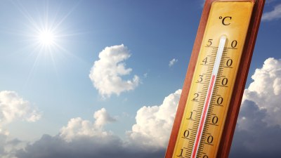
Image by panoramaphotos on Freepik
Temperature lapse rates are fundamental in understanding the dynamics of the atmosphere, especially their critical role in cloud formation. The lapse rate refers to the rate at which atmospheric temperature decreases with an increase in altitude. This temperature gradient influences how air parcels behave when they rise or descend, which in turn affects condensation processes essential for cloud development.
In the troposphere, where nearly all weather phenomena occur, the temperature usually decreases with elevation. Several types of lapse rates are defined: the environmental lapse rate (ELR), the dry adiabatic lapse rate (DALR), and the moist adiabatic lapse rate (MALR). Each of these plays a key role in determining atmospheric stability and the potential for cloud formation.
Understanding Temperature Lapse Rates
The environmental lapse rate is the actual rate of temperature decrease with altitude in the surrounding atmosphere at any specific moment and location. It varies significantly depending on geographic location, seasonal changes, and local weather conditions.
The dry adiabatic lapse rate is the theoretical rate of temperature decrease in an unsaturated parcel of air that is rising and expanding without exchanging heat with its environment. This rate is approximately 9.8°C per kilometer (or about 5.4°F per 1000 feet).
On the other hand, the moist adiabatic lapse rate applies when a rising air parcel is saturated, meaning it contains 100% relative humidity. Because condensation releases latent heat, this rate is lower than the dry rate, ranging typically from 4°C to 7°C per kilometer depending on temperature and pressure.
Atmospheric Stability and Cloud Formation
The comparison of the environmental lapse rate with the dry and moist adiabatic lapse rates determines the atmosphere's stability. Atmospheric stability influences whether air parcels will continue to rise, which is essential for cloud formation.
If the ELR is less than the MALR, the atmosphere is considered absolutely stable. Air parcels, whether dry or saturated, tend to return to their original altitude after being displaced vertically. This discourages vertical cloud development and favors clear skies or stratiform clouds.
If the ELR is greater than the DALR, the atmosphere is absolutely unstable. Air parcels, once lifted, will continue rising freely because they remain warmer than the surrounding air. This instability favors vigorous convection, leading to towering cumuliform clouds and potentially thunderstorms.
When the ELR lies between the MALR and DALR, the atmosphere is conditionally unstable. In this case, an unsaturated parcel will not rise spontaneously, but if it becomes saturated, it can become buoyant and rise, promoting cloud formation.
The Role of Moisture in Cloud Formation
For clouds to form, rising air must cool to its dew point, the temperature at which water vapor condenses into liquid droplets. The lapse rates directly influence how quickly an air parcel's temperature drops as it ascends, impacting the altitude at which condensation begins.
When a parcel of air rises and cools to its dew point, further cooling causes condensation, releasing latent heat. This release of latent heat slows the rate of cooling to the moist adiabatic lapse rate, which is why MALR is lower than DALR. This warming effect within the rising parcel affects buoyancy and thus the height and type of cloud formed.
In dry conditions, the DALR dominates; clouds may form only if the rising air reaches higher, colder altitudes. In moist conditions, the MALR means condensation can occur more readily, promoting denser cloud development at lower elevations.
Types of Clouds and Lapse Rates
Different lapse rates create conditions favoring diverse cloud types. For example, in a stable atmosphere with a low environmental lapse rate, stratiform clouds such as stratus or stratocumulus often form. These clouds have layered structures with limited vertical development.
In contrast, an unstable atmosphere with a high ELR leads to convective activity. This results in cumuliform clouds like cumulus and cumulonimbus. These clouds have significant vertical height, sometimes reaching the tropopause, producing thunderstorms and severe weather.
Conditional instability often leads to the formation of clouds like altocumulus or nimbostratus, depending on moisture availability and vertical motion in the atmosphere.
Impact of Temperature Inversions
Temperature inversions are situations where temperature increases with altitude, creating a stable layer that caps vertical motion. Such inversions inhibit the formation of clouds by preventing air parcels from rising beyond the inversion layer, trapping moisture and pollutants below.
Inversions often lead to fog formation and low stratus clouds beneath the inversion, while the air above remains clear. These phenomena highlight how lapse rates and vertical temperature profiles crucially influence cloud characteristics.
Role in Weather Prediction and Climate
Meteorologists use lapse rates to forecast weather by assessing atmospheric stability. Accurate prediction of cloud formation can help anticipate precipitation, thunderstorms, or clear conditions.
In climate studies, lapse rates indirectly affect radiation balance, humidity distribution, and convective processes. Climate models incorporate lapse rate variations to simulate cloud feedbacks and their effects on global temperatures.
Practical Examples of Lapse Rate Effects
Consider a warm, moist summer day. The ELR may be steep, and a rising air parcel quickly cools to its dew point, forming towering cumulonimbus clouds and thunderstorms. In contrast, a cool, stable winter morning may have a shallow ELR with a temperature inversion, resulting in persistent fog or stratus clouds.
Mountainous regions experience pronounced effects of lapse rates where air forced to rise over terrain cools rapidly, leading to orographic cloud formation. Understanding these processes helps anticipate localized weather phenomena critical for aviation and agriculture.
Temperature lapse rates dictate the vertical temperature profile of the atmosphere, which in turn controls air parcel buoyancy and stability. The relationships between dry, moist, and environmental lapse rates determine whether air will rise and cool sufficiently to reach saturation, forming clouds.
Moisture availability interacts with lapse rates by altering the cooling rate of rising air due to latent heat release. This interplay shapes cloud type, extent, and vertical development. Overall, lapse rates are essential parameters in understanding and predicting atmospheric processes and weather patterns.


