How Storm Systems Spin Around a Central Low
Explore how storm systems spin around a central low pressure, explaining the atmospheric dynamics and forces driving their rotation.

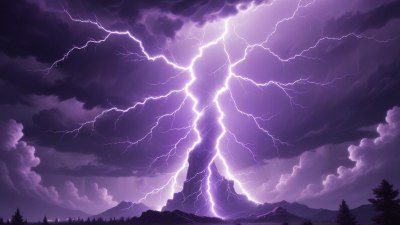
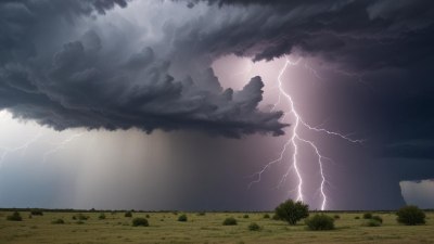
Storm systems are fascinating phenomena that play a critical role in Earth's weather patterns. A key characteristic of many storm systems is their rotation around a central low-pressure area. Understanding how these systems spin reveals much about atmospheric dynamics and helps meteorologists predict weather events more accurately.
At the core of a spinning storm system is a region of low atmospheric pressure, commonly referred to as the "central low." Atmospheric pressure is the force exerted by the weight of air molecules above a given point. In low-pressure zones, the air pressure is less than that of the surrounding areas, which creates conditions conducive to weather activity such as precipitation and wind.
The formation of the central low originates from various factors, including temperature contrasts between different air masses, surface heating, and vertical motion in the atmosphere. For example, when warm air rises due to solar heating or convergence of air masses, a mass deficit occurs near the surface, leading to decreased air pressure and the establishment of a low-pressure center.
The Role of the Coriolis Effect
One of the primary reasons storm systems spin around the central low is the Coriolis effect. This phenomenon arises because the Earth is a rotating sphere, which causes moving air to deflect relative to the Earth's surface. In the Northern Hemisphere, this deflection is to the right, while in the Southern Hemisphere, it is to the left.
Consequently, air traveling from high-pressure areas towards the low-pressure center does not move in a straight line. Instead, it curves, leading to a cyclonic rotation around the low-pressure region. The Coriolis effect prevents air from rushing directly into the low-pressure center, which would otherwise equalize pressure and dissipate the storm.
Pressure Gradient Force and Centripetal Balance
The pressure gradient force is the force that drives air from regions of high pressure toward regions of low pressure. This force acts perpendicular to isobars—lines of constant atmospheric pressure on weather maps. However, as air moves towards the center of the low, the Coriolis effect deflects it, setting the stage for rotation.
Eventually, the pressure gradient force and the Coriolis force balance in a phenomenon called geostrophic balance. When these forces are in equilibrium, air flows parallel to isobars, resulting in a steady rotational pattern around the central low. However, in storm systems, friction with the Earth's surface modifies this equilibrium, causing air to spiral inward toward the center.
Vertical Motion and Storm Development
In addition to horizontal forces, vertical motion plays a vital role in storm systems. Warm, moist air near the surface rises through convection, cooling and condensing as it ascends, forming clouds and precipitation. This vertical movement contributes to the development and intensification of the low-pressure system.
The continuous inflow of air near the surface, driven by the pressure gradient and modified by the Coriolis effect, feeds the storm's energy. As air converges and rises, the low pressure strengthens, enhancing the storm's spin. This process can lead to the development of large storm systems, such as cyclones or hurricanes, characterized by intense rotation and significant weather impacts.
Differences Between Hemispheres
Due to Earth's rotation, storm systems spin in opposite directions depending on the hemisphere. In the Northern Hemisphere, cyclones rotate counterclockwise, while in the Southern Hemisphere, they rotate clockwise. This difference is solely due to the Coriolis effect’s deflection direction.
This hemispheric distinction is crucial for meteorologists when analyzing storm development, predicting the impact, and issuing warnings. Understanding the rotation direction can also help determine the structure of the storm, the distribution of rainfall, and areas prone to strong winds.
Types of Rotating Storm Systems
There are multiple types of rotating storm systems, each with unique characteristics but all featuring rotation about a central low-pressure area. These include extratropical cyclones, tropical cyclones, and mesoscale convective systems, among others.
Extratropical cyclones, commonly known as mid-latitude cyclones, form along frontal boundaries where contrasting air masses meet. Their spin results from baroclinic instability and is influenced heavily by upper-level atmospheric winds. Tropical cyclones, on the other hand, develop over warm ocean waters and are powered primarily by latent heat release from condensation. Their rotation intensifies with warm sea surface temperatures and moisture availability.
Mesoscale convective systems are smaller in scale but can produce strong localized rotation, leading to phenomena such as tornadoes. Each type exemplifies how rotation about a central low is a fundamental feature of storm dynamics.
Influence of Friction on Storm Spin
Friction between the moving air and the Earth's surface slows the wind near the ground. This reduction in speed alters the balance of forces, causing the wind to cross isobars and move inward toward the low-pressure center rather than flowing perfectly parallel to them.
This inward spiral facilitates convergence of air at lower levels, which promotes upward motion and intensification of the storm. The frictional effect varies depending on the terrain, with rough surfaces such as forests or urban areas creating more friction and thereby affecting storm structure and intensity.
Storm Intensification and Eye Formation
As certain storm systems intensify, they develop a well-defined eye or calm center surrounded by strong winds. The eye forms due to the intense rotation and converging inflow, which causes air to rise rapidly around the periphery and descend within the center.
The descending air inhibits cloud formation in the eye, leading to clear skies and relatively calm conditions compared to the surrounding eyewall. This structure is typical in mature tropical cyclones and is a direct result of the complex interplay of pressure gradients, Coriolis effect, and thermodynamic processes driving the spinning storm.
Storm Decay and Dissipation
Over time, storm systems lose energy and weaken, leading to decay and dissipation. Factors contributing to this include moving over cooler water or land, which cuts off the energy supply, increased wind shear disrupting the storm's structure, or changes in upper-level atmospheric conditions.
As the central low weakens, the pressure gradient force lessens, reducing the storm's spin. Additionally, the inflow diminishes, and the vertical motion that sustains the storm's intensity begins to collapse, eventually leading to the storm's dissipation.
Observing Storm Rotation with Technology
Modern technology has enhanced the ability to observe and analyze storm rotation. Doppler radar, for instance, detects wind velocity and direction, enabling meteorologists to visualize the spiral movement around low-pressure centers in real time.
Satellite imagery provides views of cloud patterns and temperature measurements that help infer the structure and strength of rotating storm systems. These tools are essential in storm tracking, forecasting, and issuing timely warnings to affected regions.
Implications for Weather Prediction
Understanding how storm systems spin around a central low is fundamental for accurate weather forecasting. The storm’s rotation influences wind patterns, precipitation distribution, and potential for severe weather such as tornadoes or heavy rainfall.
Meteorological models incorporate the physics of pressure gradients, Coriolis effect, and thermodynamics to simulate storm evolution. Accurate representation of these spinning dynamics helps improve predictability, aiding in disaster preparedness and mitigation efforts.
Summary of Rotational Dynamics
Storm systems spin because of a delicate balance among several forces and atmospheric conditions. The pressure gradient force propels wind toward low pressure; however, the Coriolis effect deflects this motion, causing rotation. Friction modifies the flow near the surface, allowing air to spiral inward and rise, sustaining the low pressure and the storm’s intensity.
Vertical motion, driven by convection and latent heat release, feeds energy into the system, often leading to intensification and organized structures such as eyes and eyewalls. The direction of spin differs between hemispheres owing to Earth's rotation, and the type and strength of the storm depend on environmental conditions.
Comprehensive understanding of these mechanisms enables meteorologists and researchers to dissect storm behavior, predict their paths and intensity, and ultimately protect lives and property from severe weather events.