How Meteorologists Use Doppler Radar to Track Storms
Explore how meteorologists utilize Doppler radar technology to monitor and predict storms with accuracy and speed.
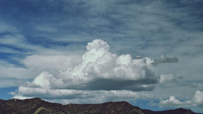
Doppler radar has revolutionized the field of meteorology by allowing scientists to track storms with unprecedented accuracy. Unlike traditional radar systems that simply detect precipitation, Doppler radar provides detailed information about the movement and intensity of storms, enabling forecasters to issue timely warnings and save lives.
At its core, Doppler radar works by sending out microwave pulses that bounce off raindrops, snowflakes, or other precipitation particles. By analyzing the frequency shift in the returned signals—a phenomenon known as the Doppler effect—meteorologists can determine the velocity of these particles relative to the radar. This velocity data is crucial for understanding storm dynamics, such as rotation or wind speed, which are key indicators of severe weather events.
Traditional radar measures reflectivity, which indicates the intensity of precipitation by the amount of energy reflected back to the radar. While this information is valuable for locating rain or snow, it doesn’t provide insight into the movement within the storm. Doppler radar adds a velocity dimension, revealing whether the precipitation is moving toward or away from the radar site and at what speed. This makes it possible to detect dangerous phenomena such as tornado vortices, microbursts, or squall lines moving rapidly along a front.
Doppler radar systems emit short bursts of electromagnetic energy into the atmosphere in a sweeping motion, covering a 360-degree radius. Each returned signal is analyzed to extract the Doppler shift, which corresponds to the component of velocity along the radar beam. Multiple successive scans create a three-dimensional map of the storm structure, enabling meteorologists to see how wind patterns evolve over time. By integrating this data with other meteorological observations, forecasters gain a comprehensive picture of the storm environment.
One of the key advantages of Doppler radar is its ability to detect rotational signatures within thunderstorms. When precipitation particles are caught in rotating updrafts, they produce distinct Doppler velocity patterns known as velocity couplets. These couplets are areas where adjacent regions exhibit wind moving in opposite directions, signaling possible tornado formation. Meteorologists monitor these signatures closely during severe weather outbreaks to issue tornado warnings as early as possible.
Additionally, Doppler radar assists in identifying wind shear – a sudden change in wind speed or direction over a short distance. Wind shear can cause rapid storm intensification or aircraft hazards and is critical information for both meteorologists and aviation officials. By tracking velocity gradients within a storm system, radar data helps predict areas prone to severe weather development.
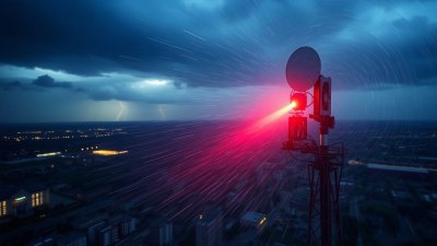
Modern Doppler radar networks, such as the U.S. National Weather Service’s NEXRAD system, continuously scan the skies across the country. Their high spatial and temporal resolution allows near real-time monitoring of storm evolution. The data is transmitted to forecast offices where it is processed and visualized using specialized software, enabling forecasters to analyze storm attributes like hook echoes, bow echoes, and mesocyclones.
Hook echoes are radar reflectivity signatures that resemble a hook-shaped appendage on the edge of a thunderstorm. Their presence is often associated with supercells and potential tornado development. Doppler velocity data permits distinguishing rotating storms from non-rotating ones by correlating velocity couplets with hook echoes. This combined approach has greatly enhanced tornado detection rates since its implementation.
Bow echoes are another radar pattern indicative of fast-moving, damaging straight-line winds ahead of a thunderstorm complex. These arcs of enhanced reflectivity correspond with strong outflow winds flushing ahead of storms. Recognizing bow echoes helps meteorologists anticipate damaging wind events and inform emergency management agencies accordingly.
Meteorologists also use Doppler radar to estimate rainfall rates, which is vital for flood forecasting. The reflectivity data from radar pulses can be converted into rainfall intensity by applying empirical relationships between reflectivity values and precipitation rates. This capability supplements ground-based rain gauge networks by offering extensive spatial coverage, especially in remote or mountainous areas.
Some advanced Doppler radar installations employ dual-polarization technology, which transmits pulses oriented both horizontally and vertically. This enhancement enables the differentiation of hydrometeor types such as rain, snow, hail, or even non-meteorological targets like birds, insects, and debris. Discriminating between precipitation types improves weather predictions and helps emergency responders assess hail damage or tornado debris fields after severe storms.
Furthermore, Doppler radar data is integral to numerical weather prediction models. By assimilating radar-derived wind and precipitation information, models can initialize atmospheric conditions more accurately. This leads to improved short-term forecasts, particularly for convective storms that evolve rapidly. The synergy between observational data and modeling forms the backbone of modern weather prediction.
Training meteorologists to interpret Doppler radar imagery is a critical part of operational meteorology. Forecasters learn to recognize signature patterns and correlate them with potential weather hazards. This expertise allows them to communicate risks effectively to the public and authorities via warnings, advisories, and forecasts.
However, Doppler radar has limitations. Its velocity measurements represent motion only along the radar beam line of sight, meaning perpendicular winds to the beam are not detected. This can result in ambiguous velocity patterns in certain storm orientations. Additionally, radar beam curvature and beam broadening with distance can degrade signal quality, reducing accuracy at far range. Terrain obstructions may also create radar shadows, leaving some areas blind to radar scans.
Overcoming these limitations has involved deploying multiple radar stations in overlapping configurations. By comparing data from different radar locations, meteorologists can better resolve three-dimensional wind vectors and overcome line-of-sight restrictions. International cooperation through radar-sharing agreements further enhances storm monitoring capabilities across borders.
The evolution of radar technology continues with developments such as phased-array radar, which can scan the atmosphere much faster than traditional mechanically steered antennas. Faster scan rates enable more timely detection of storm changes and improve warning lead times. Additionally, integration of radar data with satellite observations, lightning detection systems, and ground sensors offers a multi-dimensional approach to storm tracking.
In summary, Doppler radar is an indispensable tool for meteorologists in tracking storms, detecting severe weather signatures, estimating precipitation, and aiding numerical weather prediction. Its ability to measure both reflectivity and velocity provides a dynamic view of storm processes, significantly enhancing forecasting skill and public safety. Continued advancements in radar technology and expanded radar networks promise even greater precision in monitoring the atmosphere’s most violent phenomena.
Understanding the science behind Doppler radar also fosters public appreciation for its role in daily weather forecasting and emergency management. As storms become more frequent and intense with changing climate patterns, the importance of accurate and timely storm tracking using Doppler radar cannot be overstated.