How a Polar Vortex Forms and Why It’s Basically Atmospheric Drama
Explore how the polar vortex forms and why it acts like atmospheric drama, influencing global weather patterns and extreme cold events.

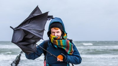
Image created with Flux Schnell
The polar vortex is a fascinating meteorological phenomenon that plays a crucial role in shaping weather patterns, particularly in the winter months. Despite its somewhat ominous name, the polar vortex is a natural and persistent feature of our planet's atmosphere. Essentially, it is a large area of low pressure and cold air surrounding the Earth's poles, primarily the North Pole in the Northern Hemisphere. Understanding how a polar vortex forms and why it behaves like a form of atmospheric drama offers insights into the complex dynamics of our climate system.
At the core of the polar vortex is a swirling mass of extremely cold air that remains roughly confined to the polar regions, driven by the Earth's rotation and the stark temperature contrast between the poles and the mid-latitudes. This vortex exists in the stratosphere, the layer of the atmosphere about 10 to 50 kilometers above the Earth's surface. The polar vortex extends down into the troposphere, where much of our weather occurs, influencing jet streams and storm tracks.
Defining the Polar Vortex
The term “vortex” refers to a spinning, often turbulent, mass of fluid or air. In this case, the polar vortex is a swirling, cyclone-like circulation of cold air centered over the poles. It’s an enormous system, easily thousands of kilometers wide, centered in the upper atmosphere around the poles. It’s strongest in the winter because the temperature difference between the pole and equator is greatest, creating steep pressure gradients.
Far from being a recent discovery, the polar vortex has been known to meteorologists for decades. It was first detected by researchers studying the stratosphere during the mid-20th century. The name may sound dramatic because the vortex can sometimes behave violently, expanding or contracting and affecting weather patterns far beyond the poles.
Formation Mechanism: Temperature and the Coriolis Effect
The formation of the polar vortex hinges on two key factors: extreme cold air over the poles and the Earth's rotation. During winter, the polar regions receive minimal sunlight, causing the air above to cool substantially. This cold air becomes denser and sinks, creating an area of low pressure. Surrounding warmer air at lower latitudes contrasts sharply with the cold core, leading to steep temperature and pressure gradients.
Earth’s rotation creates the Coriolis force, which deflects the movement of air parcels, causing the circulation of air around the poles to spin in a cyclonic pattern. In the Northern Hemisphere, this means a counterclockwise rotation; in the Southern Hemisphere, it’s clockwise. The Coriolis force prevents this frigid air from simply spilling directly down to lower latitudes, instead maintaining the coherent swirling structure of the vortex.
As this swirling mass consolidates, it forms the polar vortex as a distinct and persistent feature in the stratosphere. It acts like a containment barrier, trapping the coldest air masses in place and preventing mixing with warmer air from the mid-latitudes under normal conditions.
The Polar Vortex and Jet Streams
One of the most critical aspects of the polar vortex is its relationship to jet streams, which are fast flowing, narrow air currents in the atmosphere. The polar vortex helps maintain the polar jet stream’s path, which generally flows from west to east and acts as a barrier between cold polar air and warmer mid-latitude air.
When the polar vortex is strong and stable, it keeps the jet stream tight and well-organized, effectively containing the cold air near the poles. This results in relatively stable weather patterns, with cold air confined to high latitudes and milder conditions farther south.
However, when the polar vortex weakens or becomes unstable, the jet stream can become more wavy or meander southward. This allows frigid polar air to plunge into mid-latitude regions, sometimes leading to extreme cold spells known as cold air outbreaks. These events often grab headlines when they cause major winter storms or record low temperatures across North America, Europe, or Asia.
What Causes the Polar Vortex to Fluctuate?
The polar vortex is not a static, unchanging entity; it ebbs and flows in strength through the winter months. Several factors influence its variability, with some being naturally occurring and others related to global climate forces.
One crucial driver is sudden stratospheric warming (SSW), an event where temperatures in the stratosphere rise dramatically over a few days. This rapid warming disrupts the polar vortex, causing it to weaken, split, or become displaced from the pole. When this happens, the containment of cold air falters, allowing Arctic air to surge south.
Vigorous planetary waves - large-scale atmospheric waves that propagate up from the troposphere — can also disrupt the polar vortex. These waves increase in amplitude as they interact with mountain ranges or other geographical features and can weaken the vortex by transferring energy into the stratosphere.
El Niño and La Niña, the cyclic warming and cooling of surface waters in the tropical Pacific Ocean, can modulate the polar vortex indirectly by altering atmospheric circulation patterns globally. These changes can either reinforce or undermine the vortex depending on seasonal timing and strength.
Atmospheric Drama: Expansion, Contraction, and Splitting
The polar vortex occasionally exhibits dramatic behavior reminiscent of “atmospheric drama.” Sometimes, it contracts tightly over the pole, making it stronger and more organized. At other times, it expands or even splits into two or more lobes, redistributing cold air unevenly across different regions.
A split vortex is highly unusual but can lead to significant weather impacts. When the vortex divides, each portion carries with it cold air masses that can create severe conditions in regions typically not accustomed to such cold. This phenomenon often precedes prolonged cold winters in mid-latitude locations.
Conversely, a robust and tightly contracted polar vortex tends to mean that mid-latitudes experience milder winters. While the phrase “polar vortex” often pops up in media during cold weather events, many people don't realize that the vortex itself is persistent and generally present, but its shape and strength govern the weather drama we see on the ground.
Polar Vortex in the Context of Climate Change
Climate change adds complexity to the behavior of the polar vortex. A warming Arctic — warming at a rate twice the global average — reduces the temperature contrast between the poles and the mid-latitudes. This weakened gradient is hypothesized to destabilize the polar vortex, sometimes making it more prone to splits or displacements.
Some scientists suggest that the diminishing sea ice and altered snow cover associated with Arctic warming influence how planetary waves propagate into the stratosphere, increasing the frequency of sudden stratospheric warming events and causing more frequent polar vortex disruptions.
However, research in this area remains active and somewhat contentious, with contrasting studies debating whether a weakened polar vortex leads to colder mid-latitude winters or if general Arctic warming will ultimately reduce extreme cold outbreaks over time.
Regardless, the polar vortex serves as a key piece of the climate puzzle, acting as a natural indicator of the interplay between polar conditions and global atmospheric circulation.
The Impact on Everyday Life and Weather Forecasting
The polar vortex’s influence on weather is profound. When it weakens, people in large parts of North America, Europe, and Asia can experience outbreaks of icy cold air, sometimes bringing blizzards, power outages, and significant infrastructure challenges.
Weather forecasters closely monitor the polar vortex using satellite data, radiosonde balloon measurements, and stratospheric observations to predict the likelihood of these extreme cold events. Understanding the vortex’s dynamics improves seasonal forecasts and helps communities prepare for winter hazards.
Increased understanding of the vortex has also improved models that simulate how jet streams may shift or how storm tracks might evolve, contributing to more accurate medium-term weather forecasts.
Polar Vortex Phenomena Around the World
While most media attention focuses on the Northern Hemisphere polar vortex, the Southern Hemisphere also has a polar vortex surrounding Antarctica. The Antarctic polar vortex tends to be stronger and more stable, mainly due to Antarctica’s isolation by the Southern Ocean and the lack of large landmasses disrupting airflow.
The Southern polar vortex plays a critical role in shaping weather patterns over the southern continents and influencing phenomena such as the ozone hole created by chemical reactions in the stratosphere under extremely cold conditions.
Interestingly, because the Southern Hemisphere's polar vortex remains largely confined, extreme cold air outbreaks are less common there compared to the Northern Hemisphere, where geography and continents allow more frequent breaks in the vortex’s containment.
Myths and Misconceptions About the Polar Vortex
With increased media coverage, the polar vortex has become widely discussed but often misunderstood. One common misconception is that the polar vortex itself is new or is exclusively responsible for cold weather. In reality, the polar vortex is always present during winter and is fundamental to the global atmospheric circulation system.
Another myth is that a strong polar vortex causes severe cold spells. Typically, a strong, stable vortex keeps cold air locked in the polar region, while a weak or disrupted vortex causes cold air to spill southward, leading to the infamous winter cold snaps.
Some people also confuse the polar vortex with the jet stream. While they are related, they are distinct entities. The polar vortex is a broader low-pressure circulation mainly in the stratosphere, while the jet stream is a concentrated fast-moving air current in the troposphere.
The Polar Vortex as a Natural Climate Regulator
Far from being an unpredictable monster, the polar vortex acts as a stabilizing force in the Earth's atmosphere. It helps balance temperature extremes between the poles and equator and plays a part in redistributing heat energy through atmospheric circulation.
Its presence is a reminder of the dynamic and interconnected nature of the climate system, where patterns thousands of kilometers above influence local weather and long-term climate variability.
Scientists continue to investigate the polar vortex’s behavior to improve climate models, enhance weather forecasting, and understand how ongoing global changes will shape future atmospheric patterns.
In essence, the polar vortex is a fundamental atmospheric feature, embodying both the drama and order of Earth’s weather system.